Premstätten
Premstätten | |
|---|---|
 Coat of arms | |
 Premstätten Location within Austria | |
| Coordinates: 46°57′53″N 15°24′15″E / 46.96472°N 15.40417°E / 46.96472; 15.40417Coordinates: 46°57′53″N 15°24′15″E / 46.96472°N 15.40417°E / 46.96472; 15.40417 | |
| Country | Austria |
| State | Styria |
| District | Graz-Umgebung |
| Government | |
| • Mayor | Anton Scherbinek (ÖVP) |
| Area [1] | |
| • Total | 29.07 km2 (11.22 sq mi) |
| Elevation | 351 m (1,152 ft) |
| Population (2018-01-01)[2] | |
| • Total | 6,068 |
| • Density | 210/km2 (540/sq mi) |
| Time zone | UTC+1 (CET) |
| • Summer (DST) | UTC+2 (CEST) |
| Postal code | 8054, 8141, 8143, 8144, 8401 |
| Area code | 03136 |
| Website | www.unterpremstaetten.at |
Premstätten is since January 2016 a new market town with 5,784 residents (as of 1 January 2016) in Graz-Umgebung District of Styria, Austria. However, it was previously founded in January 2015 as the town name "Unterpremstätten-Zettling".
The municipality was founded as part of the Styria municipal structural reform,[3][4]
on 31 December 2014, from the dissolved independent municipalities Unterpremstätten and Zettling.[5]
One petition from the municipality Zettling against merging, at the Constitutional Court, was introduced but was unsuccessful.[6]
After a corresponding municipal council, the municipality carries since 2016 the name "Premstätten".[7][8]
Contents
1 Geography
1.1 Municipality arrangement
2 Politics
2.1 Mayor
2.2 Town council
2.3 Wappen
3 Infrastructure
3.1 Safety
4 Culture and sights
5 References
6 External links
Geography
Municipality arrangement
The municipal territory includes the following six sections or like-named Katastralgemeinden (areas and populations as of 1 January 2015[9]):
- Bierbaum (633; 245.62 ha or 606.9 acres)
- Hautzendorf (848; 407.28 ha or 1,006.4 acres)
- Laa (492; 399.75 ha)
- Oberpremstätten (1,247; 471.63 ha)
- Unterpremstätten (1985; 908.22 ha or 2,244.3 acres)
- Zettling (418; 493.35 ha or 1,219.1 acres)
Politics
Mayor
The first mayor after the merger, Anton Scherbinek (ÖVP), was elected by the municipal council on 20 April 2015 during the constitutive session. Until then, the Commissioner of the Government, Günter Scherübl had been in charge of official business since 1 January 2015.
Town council
The council consists of 25 members, which are made up of the following groups:
- 12 ÖVP
- 7 Liste Ingrid Baumhackl
- 4 SPÖ
- 1 FPÖ
- 1 Die Grünen
The prior elections brought the following results:
| Party | 2015 | 2010 1) | ||||
|---|---|---|---|---|---|---|
| Stimmen | % | Mandate | St. | % | M. 2) | |
ÖVP | 1378 | 45 | 12 | 1593 | 53 | |
| Liste Ingrid Baumhackl | 877 | 28 | 7 | nicht kandidiert | ||
SPÖ | 488 | 16 | 4 | 638 | 21 | |
FPÖ | 209 | 7 | 1 | 251 | 8 | |
Die Grünen | 133 | 4 | 1 | 136 | 5 | |
| Mit Josef Eisner für Unterpremstätten | nicht kandidiert | 370 | 12 | |||
| Wahlbeteiligung | 64% | 73% | ||||
1) The municipality amalgamation now carried was followed in the voting results.
2) The notional comparison election shows at Fusion municipalities summed votes of the original communities. Therefore, comparisons are not possible.
Wappen

- Old town crests

Unterpremstätten
Zettling


The coats of arms of the dissolved communities lost their official validity on January 1, 2015. The new award took effect on 25 January 2016.[10]
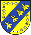
The blazon (crest description) reads:
- "Above a shield-foot with a red, silver-grooved brick wall, on the right in silver, a green spruce, on the left in blue, three natural bees".
Infrastructure
Safety
In Premstätten, the Polizeiinspektion (PI) established that the district police command is under Graz-Umgebung. The PI is locally responsible for the municipalities of Premstätten and Dobl-Zwaring.
Furthermore, the highway patrol inspection (API) Graz West for the A2 and A9 motorways has its headquarters in Premstätten Bäckweg, founded in 1974 as a department of the highway gendarmerie.[11]
Culture and sights

Schloss Premstätten
References
^ "Dauersiedlungsraum der Gemeinden Politischen Bezirke und Bundesländer - Gebietsstand 1.1.2018". Statistics Austria. Retrieved 10 March 2019..mw-parser-output cite.citation{font-style:inherit}.mw-parser-output .citation q{quotes:"""""""'""'"}.mw-parser-output .citation .cs1-lock-free a{background:url("//upload.wikimedia.org/wikipedia/commons/thumb/6/65/Lock-green.svg/9px-Lock-green.svg.png")no-repeat;background-position:right .1em center}.mw-parser-output .citation .cs1-lock-limited a,.mw-parser-output .citation .cs1-lock-registration a{background:url("//upload.wikimedia.org/wikipedia/commons/thumb/d/d6/Lock-gray-alt-2.svg/9px-Lock-gray-alt-2.svg.png")no-repeat;background-position:right .1em center}.mw-parser-output .citation .cs1-lock-subscription a{background:url("//upload.wikimedia.org/wikipedia/commons/thumb/a/aa/Lock-red-alt-2.svg/9px-Lock-red-alt-2.svg.png")no-repeat;background-position:right .1em center}.mw-parser-output .cs1-subscription,.mw-parser-output .cs1-registration{color:#555}.mw-parser-output .cs1-subscription span,.mw-parser-output .cs1-registration span{border-bottom:1px dotted;cursor:help}.mw-parser-output .cs1-ws-icon a{background:url("//upload.wikimedia.org/wikipedia/commons/thumb/4/4c/Wikisource-logo.svg/12px-Wikisource-logo.svg.png")no-repeat;background-position:right .1em center}.mw-parser-output code.cs1-code{color:inherit;background:inherit;border:inherit;padding:inherit}.mw-parser-output .cs1-hidden-error{display:none;font-size:100%}.mw-parser-output .cs1-visible-error{font-size:100%}.mw-parser-output .cs1-maint{display:none;color:#33aa33;margin-left:0.3em}.mw-parser-output .cs1-subscription,.mw-parser-output .cs1-registration,.mw-parser-output .cs1-format{font-size:95%}.mw-parser-output .cs1-kern-left,.mw-parser-output .cs1-kern-wl-left{padding-left:0.2em}.mw-parser-output .cs1-kern-right,.mw-parser-output .cs1-kern-wl-right{padding-right:0.2em}
^ "Einwohnerzahl 1.1.2018 nach Gemeinden mit Status, Gebietsstand 1.1.2018". Statistics Austria. Retrieved 9 March 2019.
^ Steiermärkische Gemeindestrukturreform
^ § 3 Abs. 1 Z 1 des Gesetzes vom 17. Dezember 2013 über die Neugliederung der Gemeinden des Landes Steiermark (Steiermärkisches Gemeindestrukturreformgesetz – StGsrG). Landesgesetzblatt für die Steiermark vom 2. April 2014. Nr. 31, Jahrgang 2014.
ZDB-ID 705127-x. S. 2.
^ § 3 Abs. 3 Z 5 des Gesetzes vom 17. Dezember 2013 über die Neugliederung der Gemeinden des Landes Steiermark (Steiermärkisches Gemeindestrukturreformgesetz – StGsrG). Landesgesetzblatt für die Steiermark vom 2. April 2014. Nr. 31, Jahrgang 2014. Template:ZDB-ID. S. 3.
^ Erkenntnis des VfGH vom 9. Dezember 2014, G 127/2014.
^ Gemeinderatsprotokoll vom 19. Mai 2015 Archived 2016-09-09 at the Wayback Machine
^ krone.at - "Schon wieder neue Gemeinde-Namen"
^ Einwohner nach Ortschaften (Excel-Datei, 766 KB); retrieved, 29 July 2015
^ 1. Verlautbarung der Steiermärkischen Landesregierung vom 14 Jänner 2016 über die Verleihung des Rechtes zur Führung eines Gemeindewappens an die Marktgemeinde Premstätten (politischer Bezirk Graz-Umgebung); retrieved, 26 January 2016
^ http://www.regionews.at/newsdetail/40_Jahre_Autobahnpolizei_Graz_West-95837 40 Jahre Autobahnpolizei Graz-West, Regionews.at 9. Oktober 2014, abgerufen 25. Dezember 2015
External links
| Wikimedia Commons has media related to Premstätten. |
"Municipal data for Premstätten". Statistik Austria.


