Clausen, Germany
Clausen | |
|---|---|
 Coat of arms | |
Location of Clausen within Südwestpfalz district 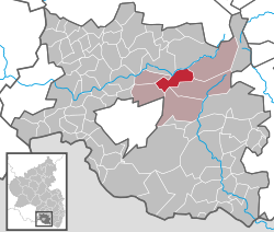 | |
 Clausen Show map of Germany  Clausen Show map of Rhineland-Palatinate | |
| Coordinates: 49°15′37″N 7°40′35″E / 49.26028°N 7.67639°E / 49.26028; 7.67639Coordinates: 49°15′37″N 7°40′35″E / 49.26028°N 7.67639°E / 49.26028; 7.67639 | |
| Country | Germany |
| State | Rhineland-Palatinate |
| District | Südwestpfalz |
| Municipal assoc. | Rodalben |
| Government | |
| • Mayor | Emil Cronauer (CDU) |
| Area [1] | |
| • Total | 12.45 km2 (4.81 sq mi) |
| Elevation | 400 m (1,300 ft) |
| Population (2017-12-31)[2] | |
| • Total | 1,403 |
| • Density | 110/km2 (290/sq mi) |
| Time zone | CET/CEST (UTC+1/+2) |
| Postal codes | 66978 |
| Dialling codes | 06333 |
| Vehicle registration | PS |
| Website | www.clausen.de |
Clausen is a municipality in Südwestpfalz district, in Rhineland-Palatinate, western Germany. Clausen belongs to the local association community of Rodalben.

Fountain of pots
The US Army's 636th Ordnance Company guarded and maintained the then classified stocks of GB and VX nerve gas located at Site 59 in Clausen. The nerve agents at Site 59, were removed under Operation Steel Box in 1990. These shells were poorly maintained and had numerous leaks from the caustic chemicals that they contained. The soldiers stationed there have since had numerous related physical and mental conditions. In addition, the fence line was supposedly sprayed with Agent Orange to deter weeds. A maintenance program in 1979 removed a number of broken shells and replaced the gaskets on those that were still uncompromised. The shells were transported by truck, rail and ship ultimately ending up at Johnston Atoll for incineration at the Johnston Atoll Chemical Agent Disposal System facility. Site 59 was sold and the bunkers were used to grow mushrooms. The area also had solar panels added for power generation. There is a 2.5 ton truck buried under the circular area used as a heliport - the truck was stolen from Pirmasens' base and used for spare parts during an inspection in 1976. A M151 Jeep in also buried next to the nearby bunker.
When the US military began to downsize in the 1990s, the small US Army posts associated with Husterhoeh Kaserne (Pirmasens) were returned to Germany, including ones located at Maßweiler, Munchweiler, Fischbach, and Clausen.
Clausen's primary industry is agricultural though it is a short drive to Pirmasens. It is located nearby the recreation area Clausensee and the area has many opportunities for outdoor recreation. The fields east of Clausen contain many concrete tank barriers remaining from WWII.
References
^ "Alle politisch selbständigen Gemeinden mit ausgewählten Merkmalen am 31.12.2018 (4. Quartal)". DESTATIS. Archived from the original on 10 March 2019. Retrieved 10 March 2019..mw-parser-output cite.citation{font-style:inherit}.mw-parser-output .citation q{quotes:"""""""'""'"}.mw-parser-output .citation .cs1-lock-free a{background:url("//upload.wikimedia.org/wikipedia/commons/thumb/6/65/Lock-green.svg/9px-Lock-green.svg.png")no-repeat;background-position:right .1em center}.mw-parser-output .citation .cs1-lock-limited a,.mw-parser-output .citation .cs1-lock-registration a{background:url("//upload.wikimedia.org/wikipedia/commons/thumb/d/d6/Lock-gray-alt-2.svg/9px-Lock-gray-alt-2.svg.png")no-repeat;background-position:right .1em center}.mw-parser-output .citation .cs1-lock-subscription a{background:url("//upload.wikimedia.org/wikipedia/commons/thumb/a/aa/Lock-red-alt-2.svg/9px-Lock-red-alt-2.svg.png")no-repeat;background-position:right .1em center}.mw-parser-output .cs1-subscription,.mw-parser-output .cs1-registration{color:#555}.mw-parser-output .cs1-subscription span,.mw-parser-output .cs1-registration span{border-bottom:1px dotted;cursor:help}.mw-parser-output .cs1-ws-icon a{background:url("//upload.wikimedia.org/wikipedia/commons/thumb/4/4c/Wikisource-logo.svg/12px-Wikisource-logo.svg.png")no-repeat;background-position:right .1em center}.mw-parser-output code.cs1-code{color:inherit;background:inherit;border:inherit;padding:inherit}.mw-parser-output .cs1-hidden-error{display:none;font-size:100%}.mw-parser-output .cs1-visible-error{font-size:100%}.mw-parser-output .cs1-maint{display:none;color:#33aa33;margin-left:0.3em}.mw-parser-output .cs1-subscription,.mw-parser-output .cs1-registration,.mw-parser-output .cs1-format{font-size:95%}.mw-parser-output .cs1-kern-left,.mw-parser-output .cs1-kern-wl-left{padding-left:0.2em}.mw-parser-output .cs1-kern-right,.mw-parser-output .cs1-kern-wl-right{padding-right:0.2em}
^ "Bevölkerungsstand 2017 - Gemeindeebene". Statistisches Landesamt Rheinland-Pfalz (in German). 2018.
Towns and municipalities in Südwestpfalz | ||
|---|---|---|
| ||
Authority control |
|
|---|
This Südwestpfalz location article is a stub. You can help Wikipedia by expanding it. |


