El Taref Province
El Taref Province ولاية الطارف | |
|---|---|
Province | |
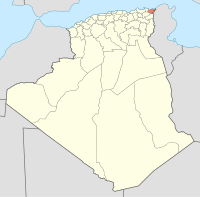
 Map of Algeria highlighting El Taref | |
| Coordinates: 36°46′N 8°19′E / 36.767°N 8.317°E / 36.767; 8.317Coordinates: 36°46′N 8°19′E / 36.767°N 8.317°E / 36.767; 8.317 | |
| Country | |
| Capital | El Taref |
| Area | |
| • Total | 3,339 km2 (1,289 sq mi) |
| Population (2008)[1] | |
| • Total | 411,783 |
| • Density | 120/km2 (320/sq mi) |
| Time zone | UTC+01 (CET) |
| Area Code | +213 (0) 38 |
| ISO 3166 code | DZ-36 |
| Districts | 7 |
| Municipalities | 24 |
El Taref (Arabic: ولاية الطارف, French: Wilaya d'El Tarf) is a province (wilaya) of Algeria. El Kala is a port town in this province. El Taref is the capital city. El Kala, a port town in this province, is home to El Kala National Park.
Contents
1 Administrative divisions
1.1 Districts
1.2 Communes
2 References
Administrative divisions
It is made up of 7 districts, divided into 24 municipalities.
Districts
- Ben M'Hidi
- Besbes
- Bouhadjar
- Boutheldja
- Dréan
- El Kala
- El Taref
Communes
- Ain El Assel
- Ain Kerma
- Asfour
- Ben Mehdi
- Beni Amar
- Berrihane
- Besbes
- Bougous
- Bouhadjar
- Bouteldja
- Chebaita Mokhtar
- Chefia
- Chihani
- Dréan
- El Aioun
- El Kala
- El Taref
- Hammam Beni Salah
- Lac des Oiseaux
- Oued Zitoun
- Raml Souk Souarekh
- Zerizer
- Zitouna
References
^ Office National des Statistiques, Recensement General de la Population et de l’Habitat 2008 Archived July 24, 2008, at the Wayback Machine Preliminary results of the 2008 population census. Accessed on 2008-07-02.
Capital: El Taref | ||
| Districts |
|  |
| Communes |
| |
Provinces of Algeria | ||
|---|---|---|
| ||
This article about a location in El Taref Province is a stub. You can help Wikipedia by expanding it. |


