Brown Hill Creek
| Brown Hill Creek Kaurna: Willawilla | |
|---|---|
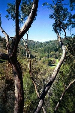 Brown Hill Creek near Mitcham | |
 Location of the creek mouth in South Australia | |
| Location | |
| Country | Australia |
| State | South Australia |
| Region | Metropolitan Adelaide |
| Town | Brown Hill Creek |
| Physical characteristics | |
| Source | Mount Lofty Ranges |
| Mouth | Patawalonga River |
- location | south of Mitcham |
- coordinates | 34°59′02″S 138°39′04″E / 34.984°S 138.651°E / -34.984; 138.651Coordinates: 34°59′02″S 138°39′04″E / 34.984°S 138.651°E / -34.984; 138.651 |
| Basin features | |
| River system | Patawalonga River |
| Nature reserve | Brownhill Creek Recreation Park |
Brown Hill Creek, also known as Willawilla in the Kaurna language,[1] is a watercourse flowing from the Adelaide Hills through in the inner south suburbs of the Adelaide metropolitan area, in the Australian state of South Australia. It is part of the Patawalonga River catchment.
Contents
1 Course and features
2 Human use
3 See also
4 References
Course and features
The creek rises on the western slopes of the Mount Lofty Ranges near Crafers and flows generally in a west-north-west direction through the suburb of Brown Hill Creek, south of Brown Hill, a prominent hill rising immediately south-east of Mitcham village, and beneath the historic Keystone Bridge in Mitcham itself, the vicinity traditionally known as Wirraparinga.
From Mitcham the creek continues along a north-western path through Torrens Park, Hawthorn, Unley Park, Millswood and Forestville before flowing into a constructed drain at Forestville Reserve. From there the flows are directed through inner south-west suburbs to join the Patawalonga River on the southern edge of Adelaide Airport, near Netley.
State government records state that the full downstream extent of the original creek is unknown due to the construction of drains along the creek line.[1]
Human use
The area beside the creek in the suburbs of Mitcham and Brown Hill Creek was known to the Kaurna people of the Adelaide Plains as Wirraparinga, meaning "creek and scrub place".
The creek valley south of Brown Hill is home to Brownhill Creek Recreation Park[2] and has been the site a recreation park since the late 1800s. A bathing hole was established at a constructed dam on the creek near Mitcham village in 1894 but was removed eight years later to protect the interests of market gardeners.[3] A camping ground at the entrance to the valley was declared in 1954 in the 120-acre (49 ha) "National Pleasure resort"[3] and a stone plaque declaring a "pleasure resort" from the early part of the 20th century still stands at the site. A caravan park is presently located at the site of the original camping ground and the recreation reserve extends several kilometres upstream into the main creek valley.
The upper reaches of the creek are utilised especially for market gardening and also watering pasture. In the 1870s, some of the upper gullies of the creek were considered as a possible location for a reservoir to supply Adelaide's growing population with water.[citation needed]Thorndon Park Reservoir was eventually built instead.
See also
@media all and (max-width:720px){.mw-parser-output .mobile-float-reset{float:none!important;width:100%!important}}.mw-parser-output .stack-container{box-sizing:border-box}.mw-parser-output .stack-clear-left{float:left;clear:left}.mw-parser-output .stack-clear-right{float:right;clear:right}.mw-parser-output .stack-left{float:left}.mw-parser-output .stack-right{float:right}.mw-parser-output .stack-object{margin:1px;overflow:hidden}
- List of rivers of South Australia
References
^ ab "Placename Details: Brown Hill Creek". Property Location Browser. Government of South Australia. 8 February 2012. SA0009971. Retrieved 10 April 2017.Derivation of Name: After the adjacent hill; Dual Name: Brown Hill Creek / Willawilla; Other Details: Also known as Willawilla or Wirraparinga. Kaurna people advised that the traditinal name is Willawilla. Shown as Brownhill Creek on 1:10 000 & 1:50 000 Mapsheets. Full extent of creek not determined due to the construction of drains along the creek line. Colonel William Light's plan of Adelaide published in 1839 shows the spelling as Brown Hill Creek. Dual named 3/2/2011.
.mw-parser-output cite.citation{font-style:inherit}.mw-parser-output .citation q{quotes:"""""""'""'"}.mw-parser-output .citation .cs1-lock-free a{background:url("//upload.wikimedia.org/wikipedia/commons/thumb/6/65/Lock-green.svg/9px-Lock-green.svg.png")no-repeat;background-position:right .1em center}.mw-parser-output .citation .cs1-lock-limited a,.mw-parser-output .citation .cs1-lock-registration a{background:url("//upload.wikimedia.org/wikipedia/commons/thumb/d/d6/Lock-gray-alt-2.svg/9px-Lock-gray-alt-2.svg.png")no-repeat;background-position:right .1em center}.mw-parser-output .citation .cs1-lock-subscription a{background:url("//upload.wikimedia.org/wikipedia/commons/thumb/a/aa/Lock-red-alt-2.svg/9px-Lock-red-alt-2.svg.png")no-repeat;background-position:right .1em center}.mw-parser-output .cs1-subscription,.mw-parser-output .cs1-registration{color:#555}.mw-parser-output .cs1-subscription span,.mw-parser-output .cs1-registration span{border-bottom:1px dotted;cursor:help}.mw-parser-output .cs1-ws-icon a{background:url("//upload.wikimedia.org/wikipedia/commons/thumb/4/4c/Wikisource-logo.svg/12px-Wikisource-logo.svg.png")no-repeat;background-position:right .1em center}.mw-parser-output code.cs1-code{color:inherit;background:inherit;border:inherit;padding:inherit}.mw-parser-output .cs1-hidden-error{display:none;font-size:100%}.mw-parser-output .cs1-visible-error{font-size:100%}.mw-parser-output .cs1-maint{display:none;color:#33aa33;margin-left:0.3em}.mw-parser-output .cs1-subscription,.mw-parser-output .cs1-registration,.mw-parser-output .cs1-format{font-size:95%}.mw-parser-output .cs1-kern-left,.mw-parser-output .cs1-kern-wl-left{padding-left:0.2em}.mw-parser-output .cs1-kern-right,.mw-parser-output .cs1-kern-wl-right{padding-right:0.2em}
^ "Brownhill Creek Recreation Park". Department of Environment, Government of South Australia.
^ ab "Brown Hill Creek". City of Mitcham. Retrieved 10 January 2017.


