Chino, California
| Chino, California | ||
|---|---|---|
City | ||
City of Chino | ||
| ||
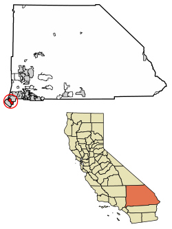 Location of Chino in San Bernardino County, California. | ||
 Chino, California Location in the United States | ||
Coordinates: 34°1′4″N 117°41′24″W / 34.01778°N 117.69000°W / 34.01778; -117.69000Coordinates: 34°1′4″N 117°41′24″W / 34.01778°N 117.69000°W / 34.01778; -117.69000 | ||
| Country | ||
| State | ||
| County | ||
| Incorporated | February 28, 1910[1] | |
| Government | ||
| • Type | Council-manager | |
| • City council[3] | Mayor Dennis R. Yates Mayor Pro Tem Eunice M. Ulloa Glenn Duncan Tom Haughey Earl C. Elrod | |
| • City manager | Matthew Ballantyne[2] | |
| Area[4] | ||
| • Total | 29.68 sq mi (76.86 km2) | |
| • Land | 29.66 sq mi (76.83 km2) | |
| • Water | 0.01 sq mi (0.03 km2) 0.04% | |
| Elevation[5] | 728 ft (222 m) | |
| Population (2010)[6] | ||
| • Total | 77,983 | |
| • Estimate (2016)[7] | 87,776 | |
| • Density | 2,959.01/sq mi (1,142.48/km2) | |
| Time zone | UTC-8 (Pacific) | |
| • Summer (DST) | UTC-7 (PDT) | |
| ZIP codes | 91708, 91710 | |
| Area code | 909 | |
| FIPS code | 06-13210 | |
GNIS feature IDs | 1660477, 2409453 | |
| Website | www.cityofchino.org | |

Chino is a city in San Bernardino County, California, United States. It is located in the western end of the Riverside-San Bernardino Area and it is easily accessible via the Chino Valley (71) and Pomona (60) freeways.
Chino is bounded by Chino Hills to the west, Pomona to the northwest, unincorporated San Bernardino County (near Montclair) to the north, Ontario to the northeast, Eastvale to the Southeast, and unincorporated Riverside County to the south. The population was 77,983 at the 2010 census.
Chino and its surroundings have long been a center of agriculture and dairy farming, serving the considerable demands for milk products in Southern California and much of the southwestern United States. Chino's rich agricultural history dates back to the Spanish land grant forming Rancho Santa Ana del Chino. The area specialized in orchard, row crops and dairy. Downtown Chino is home to satellite branches of the San Bernardino County Library and Chaffey Community College, the Chino Community Theatre, the Chino Boxing Club and a weekly Farmer's Market. In 2008, the city of Chino was awarded the prestigious "100 Best Communities for Youth" award for the second time in three years.[8] Chino hosted shooting events for the 1984 Summer Olympics at the Prado Olympic Shooting Park in the Prado Regional Park. Two California state prisons for adults (California Institution for Men and California Institution for Women), as well as the Heman G. Stark Youth Correctional Facility, lie within the city limits.[9]
Contents
1 Etymology
2 History
3 Economy
3.1 Top employers
4 Education
5 Geography
5.1 Climate
6 Demographics
6.1 2010
6.2 2000
7 Government
7.1 Federal and state representation
8 Attractions
9 Chino in popular culture
10 See also
11 References
12 External links
Etymology
The land grant on which the town was founded was called Rancho Santa Ana del Chino. Santa Ana is Spanish for Saint Anne, but the exact meaning of "Chino" has been explained in different ways. One explanation is that the "Chino" (curly-haired person or mixed-race person) was the chief of the local Native American village.[10] The president of the Chino Valley Historical Society, drawing on US Civil War-era letters, designates the "curl" referenced in the toponym as that at the top of the grama grass that abounded in the valley.[11]
History
The first inhabitants of Chino in modern times were the Tongva, who had a settlement called Wapijangna in the Santa Ana River watershed. Some residents of Wapijanga were baptized at Mission San Gabriel, which was established in 1771. The Spanish crown claimed the land, at least nominally, until Mexican independence was finalized and possession fell to the Mexican government.
Some twenty years later, Mexican governor of Alta California Juan Bautista Alvarado granted Rancho Santa Ana del Chino to Antonio Maria Lugo of the prominent Lugo family. Two years later, his successor, Governor Micheltorena, granted an additional three leagues to Lugo's son-in-law Isaac Williams, who took charge of the rancho. Williams kept large quantities of horses and cattle, which attracted the envy of raiding Native Americans as well as unscrupulous whites. One of the latter was James Beckwourth, who, in 1840, posed as an otter hunter and stayed at Rancho Chino to determine the location of the area's animals, which he then reported to Walkara, the Ute mastermind of the raids.
Early in the Mexican–American War, the Battle of Chino took place at Williams' rancho. The battle ended prior to the arrival of the Mormon Battalion, dispatched on behalf of the United States, who instead labored in the rancho's agricultural harvest and constructed a grist mill.
During the California Gold Rush, the rancho was a popular stopover for travelers, and in the mining fury, coal was discovered there. In 1850, California was admitted to the union, and the process of separating privately held lands from the public domain began. The Williams claim to the Chino Rancho was patented in 1869.

Beet sugar factory c.1906
Richard Gird was the next owner of the Rancho. Beginning in 1887, his land was subdivided and laid out. It became the 'Town of Chino,' and incorporated into a city in 1910.[12] Sugar beets, corn, and alfalfa were raised there.
The Chino Valley, located at the foot of an alluvial plain with fertile topsoil reaching depths of 4 feet, was an agricultural mecca from the 1890s up through the mid 20th century. Sugar beets were a significant part of the economy in the early 1900s, followed by sweet corn (marketed as "Chino corn" throughout the Pacific coast area), peaches, walnuts, tomatoes, and strawberries. The city's official logo/crest features an overflowing cornucopia.

Chino Valley Creamery, c.1900
The dairy industry flourished from the 1950s through the 1980s, with dairy-friendly zoning in the southwest corner of San Bernardino County encouraging many ethnic Dutch families to locate there and become the cornerstone of the industry. Chino's large, highly efficient dairies made it the largest milk-producing community in the nation's largest milk-producing state.
Because of its pastoral setting and rural flavor, Chino was a popular site for Hollywood crews to shoot "midwestern" settings. 1960's movies included Bus Riley's Back in Town starring Ann-Margret and Michael Parks; The Stripper, with Joanne Woodward, and the mid-60s TV series Twelve O'Clock High, re-fashioning Chino's rural airport as a British airfield with quonset huts among farm fields.
In the 1970s, Chino developed into a small suburban city, forming the western anchor of the Inland Empire region, and now the city's development has gradually taken on a more middle-class character. There are still many industrial areas as well as farm animals such as goats and chickens. According to the 2004 FBI UCR, the city had about 3.6 violent crimes per 1,000 population, which is typical for an American suburb, and its property crime below average.
On July 11, 2017, in a special election, Chino voters voted against Measure H, which would have allowed 30 acres of rural land located near Ontario, to be used to build a total of 180 new homes by home builder D.R. Horton. The measure faced considerable opposition by residents of the city despite support from the Chino Chamber of Commerce and school district.
Economy
Top employers
According to the City's 2011 Comprehensive Annual Financial Report,[13] the top employers in the city are:
| # | Employer | # of Employees |
|---|---|---|
| 1 | Chino Valley Unified School District | Over 1,000 |
| 2 | California Institution for Men | Over 1,000 |
| 3 | California Institution for Women | 500-1,000 |
| 4 | Chino Valley Medical Center | 500-1,000 |
| 5 | Wal-Mart | fewer than 500 |
| 6 | Hussmann | fewer than 500 |
| 7 | Best Buy | fewer than 500 |
| 8 | Nature's Best | fewer than 500 |
| 9 | Mission Linen Supply | fewer than 500 |
| 10 | Target | fewer than 500 |
| 11 | Omnia Furniture | fewer than 500 |
| 12 | AEP Industries | fewer than 500 |
| 13 | J. C. Penney | fewer than 500 |
| 14 | Farmers Insurance Group | fewer than 500 |
| 15 | ClosetMaid | fewer than 500 |
Education
Chino is a part of the Chino Valley Unified School District.
Chino has had 12 elementary schools:
- El Rancho Elementary (Closed in 2008-2009 School Year)
- Alicia Cortez Elementary
- Newman Elementary
- E.J. Marshall Elementary
- Dickson Elementary
- Anna Borba Fundamental
- Howard Cattle Elementary
- Richard Gird Elementary (Closed in 2008-2009 School Year)
- Edwin Rhodes Elementary
- Cal Aero Preserve Academy
- Walnut Avenue Elementary
- Liberty Elementary
Chino has 4 junior high schools:
- Briggs Junior High School
- Ramona Junior High School
- Magnolia Junior High School
- Woodcrest Junior High School
Chino has 3 high schools:
- Don Antonio Lugo High School
- Buena Vista High School
- Chino High School
Chino has 1 charter school:
- Oxford Preparatory Academy (Closed)
- Allegiance STEAM Academy
Chino has 1 Fundamental School:
- Lyle S. Briggs Fundamental School (K-8th Grade)
Chino is serviced by a satellite center of Chaffey College, a community college.
Geography
Chino is located at 34°1′4″N 117°41′24″W / 34.01778°N 117.69000°W / 34.01778; -117.69000 (34.017765, -117.689990).[14] According to the United States Census Bureau, the city has a total area of 29.7 square miles (77 km2). 29.6 square miles (77 km2) of it is land and 0.04% is water.
- Chino is a suburb in San Bernardino County, located 33 miles (53 km) from the county seat, San Bernardino.
- Los Angeles, 35 miles (56 km)
- Riverside, 26 miles (42 km)
- Santa Ana, 30 miles (48 km)
- Anaheim, 24 miles (39 km)
Climate
According to the Köppen Climate Classification system, Chino has a warm-summer Mediterranean climate, abbreviated "Csa" on climate maps.[15]
| Climate data for Chino, California | |||||||||||||
|---|---|---|---|---|---|---|---|---|---|---|---|---|---|
| Month | Jan | Feb | Mar | Apr | May | Jun | Jul | Aug | Sep | Oct | Nov | Dec | Year |
| Record high °F (°C) | 91 (33) | 94 (34) | 100 (38) | 104 (40) | 106 (41) | 108 (42) | 120 (49) | 109 (43) | 113 (45) | 107 (42) | 97 (36) | 93 (34) | 113 (45) |
| Average high °F (°C) | 68 (20) | 69 (21) | 71 (22) | 76 (24) | 79 (26) | 84 (29) | 90 (32) | 92 (33) | 89 (32) | 80 (27) | 74 (23) | 68 (20) | 78 (26) |
| Average low °F (°C) | 43 (6) | 45 (7) | 47 (8) | 49 (9) | 54 (12) | 58 (14) | 62 (17) | 62 (17) | 60 (16) | 55 (13) | 47 (8) | 42 (6) | 52 (11) |
| Record low °F (°C) | 21 (−6) | 23 (−5) | 26 (−3) | 29 (−2) | 34 (1) | 39 (4) | 37 (3) | 43 (6) | 38 (3) | 29 (−2) | 24 (−4) | 22 (−6) | 21 (−6) |
| Average precipitation inches (mm) | 3.11 (79) | 4.76 (120.9) | 2.63 (66.8) | 1.20 (30.5) | .23 (5.8) | .09 (2.3) | .00 (0) | .03 (0.8) | .15 (3.8) | 1.05 (26.7) | 1.62 (41.1) | 2.45 (62.2) | 17.32 (439.9) |
| Source: [16] | |||||||||||||
Demographics
| Historical population | |||
|---|---|---|---|
| Census | Pop. | %± | |
| 1930 | 3,118 | — | |
| 1940 | 4,204 | 34.8% | |
| 1950 | 5,784 | 37.6% | |
| 1960 | 10,305 | 78.2% | |
| 1970 | 20,411 | 98.1% | |
| 1980 | 40,165 | 96.8% | |
| 1990 | 59,682 | 48.6% | |
| 2000 | 67,168 | 12.5% | |
| 2010 | 77,983 | 16.1% | |
| Est. 2016 | 87,776 | [7] | 12.6% |
| U.S. Decennial Census[17] | |||
2010
The 2010 United States Census[18] reported that Chino had a population of 77,983. The population density was 2,629.9 people per square mile (1,015.4/km²). The racial makeup of Chino was 43,981 (56.4%) White (27.8% Non-Hispanic White),[19] 4,829 (6.2%) African American, 786 (1.0%) Native American, 8,159 (10.5%) Asian, 168 (0.2%) Pacific Islander, 16,503 (21.2%) from other races, and 3,557 (4.6%) from two or more races. Hispanic or Latino of any race were 41,993 persons (53.8%).
The Census reported that 70,919 people (90.9% of the population) lived in households, 164 (0.2%) lived in non-institutionalized group quarters, and 6,900 (8.8%) were institutionalized.
There were 20,772 households, out of which 9,979 (48.0%) had children under the age of 18 living in them, 12,426 (59.8%) were married couples living together, 3,041 (14.6%) had a female householder with no husband present, 1,469 (7.1%) had a male householder with no wife present. There were 1,185 (5.7%) households of unmarried couples; of which 147 (0.7%) were same-sex. 2,840 households (13.7%) were made up of individuals and 1,020 (4.9%) had someone living alone who was 65 years of age or older. The average household size was 3.41. There were 16,936 families (81.5% of all households); the average family size was 3.72.
The population was spread out with 19,737 people (25.3%) under the age of 18, 8,530 people (10.9%) aged 18 to 24, 25,091 people (32.2%) aged 25 to 44, 18,954 people (24.3%) aged 45 to 64, and 5,671 people (7.3%) who were 65 years of age or older. The median age was 33.2 years. For every 100 females, there were 105.7 males. For every 100 females age 18 and over, there were 105.2 males.
There were 21,797 housing units at an average density of 735.1 per square mile (283.8/km²), of which 14,315 (68.9%) were owner-occupied, and 6,457 (31.1%) were occupied by renters. The homeowner vacancy rate was 2.1%; the rental vacancy rate was 6.4%. 49,280 people (63.2% of the population) lived in owner-occupied housing units and 21,639 people (27.7%) lived in rental housing units.
According to the 2010 United States Census, Chino had a median household income of $71,671, with 9.6% of the population living below the federal poverty line.[19]
2000
As of the census[20] of 2000, there were 67,168 people, 17,304 households, and 14,102 families residing in the city. The population density was 3,190.5 inhabitants per square mile (1,232.0/km²). There were 17,898 housing units at an average density of 850.2 per square mile (328.3/km²). The racial makeup of the city was 55.7% White, 7.8% African American, 0.9% Native American, 4.9% Asian, 0.2% Pacific Islander, 25.6% from other races, and 4.9% from two or more races. Hispanic or Latino of any race were 47.4% of the population.
There were 17,304 households out of which 47.3% had children under the age of 18 living with them, 62.5% were married couples living together, 12.9% had a female householder with no husband present, and 18.5% were non-families. 14.1% of all households were made up of individuals and 5.2% had someone living alone who was 65 years of age or older. The average household size was 3.4 and the average family size was 3.8.
In the city, the population was spread out with 28.5% under the age of 18, 12.3% from 18 to 24, 34.2% from 25 to 44, 19.2% from 45 to 64, and 5.9% who were 65 years of age or older. The median age was 31 years. For every 100 females, there were 124.3 males. For every 100 females age 18 and over, there were 133.1 males.
The median income for a household in the city was $55,401, and the median income for a family was $59,638. Males had a median income of $35,855 versus $30,267 for females. The per capita income for the city was $17,574. About 6.3% of families and 8.3% of the population were below the poverty line, including 10.0% of those under age 18 and 8.5% of those age 65 or over.
Government
The city is governed by a five-member council consisting of a mayor plus four councilmembers, all of whom are elected at-large and serve four-year terms. The city manager and city attorney are appointed by the council.[3] The city's elections, which are plurality, are held on a Tuesday after the first Monday in November of even-numbered years.
Federal and state representation
With respect to the United States House of Representatives, Chino is in the 35th and 39th congressional districts,[21] which are represented by Norma Torres (D–Pomona) and Ed Royce (R–Fullerton), respectively.[22]
With respect to the California State Legislature, Chino is in the 20th Senate District, represented by Democrat Connie Leyva, and in the 52nd Assembly District, represented by Democrat Freddie Rodriguez.[23]
Attractions
Planes of Fame is an air museum at Chino Airport.
Yanks Air Museum is another air museum at Chino Airport.
Chino in popular culture
The term Chino is often mentioned in music and television but usually in reference to the prison located there and not the city.
- Members from the alternative pop band Echosmith are from Chino.
- Women's Basketball star Diana Taurasi raised in Chino
Sedrick Ellis, former NFL player was born in Chino- NASCAR driver Kenny Hendrick was born in Chino
- In the film The Big Lebowski, Walter (John Goodman) mentions Jesus Quintana, played by John Turturro, served six months in Chino's prison for exposing himself to an eight-year-old boy.
- In the television series The O.C., the main character, Ryan Atwood, is a tough kid from Chino adopted into a wealthy family in Newport Beach. In the series, Chino is depicted as a dreary slum. The negative depiction of Chino led to complaints from city officials that Chino was being depicted as a "dirtbag town."[24]
- Chino was used as a location during the filming of the movies Macabre and Back to the Future, particularly the latter's farmland setting when Marty first travels back in time to 1955.
- Chino is mentioned in Alejandro Escovedo's song "Smoke", off the album Real Animal.
- Chino is mentioned in Robert Hunter's song "Friend of the Devil", performed by the Grateful Dead.
- California governor Arnold Schwarzenegger, while giving a speech in Chico, CA, referred to that city as "Chino".
- In the song "Original Prankster" by The Offspring.
The Mountain Goats have written several songs about Chino. The song "Going to Chino" applauds the city for its rich agriculture and accredited medical care. The song "Pigs That Ran Straightaway into the Water, Triumph of", about being sent to prison, makes references to Chino.- In the movie Heat starring Robert De Niro and Al Pacino, the men's prison in Chino is referred to as a "gladiator academy".[25]
- In the movie 2 Fast 2 Furious Chino is referenced.
The Blasters refer to doing time at Chino State Prison in a song on their live album.- In the movie, American History X, the protagonist was sent to the Chino State Prison.
- In the sitcom The Big Bang Theory Season 1 Episode 4, Penny drives Sheldon to the Supermarket in "Pasadena" which in actuality is Central Ave in Chino.
- An episode of The Tyra Banks Show was filmed at the California Institution for Women, located in southeast Chino.
Sideshow Bob, on an episode of The Simpsons, longed for the later curfew hours in Chino, but the guard assured him that he spoke with the warden at Chino, and that the curfew was the same.- On a skit of Saturday Night Live ("The Californians") Trey (Kenan Thompson) unexpectedly shows up at a party, then Stewart (Fred Armisen) says that he's "supposed to be at the Chino Correctional Facility".
Snoop Dogg mentions having a house out in the hills right next to Chino in his duet with the late Tupac Shakur in the song 2 of Amerikaz Most Wanted, referring to his house in nearby Diamond Bar.
Jim Rockford visited Chino Prison during one of his cases in The Rockford Files
See also
- List of largest California cities by population
References
^ "California Cities by Incorporation Date". California Association of Local Agency Formation Commissions. Archived from the original (Word) on November 3, 2014. Retrieved August 25, 2014..mw-parser-output cite.citation{font-style:inherit}.mw-parser-output q{quotes:"""""""'""'"}.mw-parser-output code.cs1-code{color:inherit;background:inherit;border:inherit;padding:inherit}.mw-parser-output .cs1-lock-free a{background:url("//upload.wikimedia.org/wikipedia/commons/thumb/6/65/Lock-green.svg/9px-Lock-green.svg.png")no-repeat;background-position:right .1em center}.mw-parser-output .cs1-lock-limited a,.mw-parser-output .cs1-lock-registration a{background:url("//upload.wikimedia.org/wikipedia/commons/thumb/d/d6/Lock-gray-alt-2.svg/9px-Lock-gray-alt-2.svg.png")no-repeat;background-position:right .1em center}.mw-parser-output .cs1-lock-subscription a{background:url("//upload.wikimedia.org/wikipedia/commons/thumb/a/aa/Lock-red-alt-2.svg/9px-Lock-red-alt-2.svg.png")no-repeat;background-position:right .1em center}.mw-parser-output .cs1-subscription,.mw-parser-output .cs1-registration{color:#555}.mw-parser-output .cs1-subscription span,.mw-parser-output .cs1-registration span{border-bottom:1px dotted;cursor:help}.mw-parser-output .cs1-hidden-error{display:none;font-size:100%}.mw-parser-output .cs1-visible-error{font-size:100%}.mw-parser-output .cs1-subscription,.mw-parser-output .cs1-registration,.mw-parser-output .cs1-format{font-size:95%}.mw-parser-output .cs1-kern-left,.mw-parser-output .cs1-kern-wl-left{padding-left:0.2em}.mw-parser-output .cs1-kern-right,.mw-parser-output .cs1-kern-wl-right{padding-right:0.2em}
^ "City Council". City of Chino, CA. Retrieved January 14, 2015.
^ ab "Administration". City of Chino, CA. Retrieved January 14, 2015.
^ "2016 U.S. Gazetteer Files". United States Census Bureau. Retrieved Jul 19, 2017.
^ "Chino". Geographic Names Information System. United States Geological Survey. Retrieved October 22, 2014.
^ "Chino (city) QuickFacts". United States Census Bureau. Retrieved March 5, 2015.
^ ab "Population and Housing Unit Estimates". Retrieved June 9, 2017.
^ Chino Amongst the "100 Best" Again Accessed 13 November 2008
^ Mayor Takes a Stand on Prison Population. Archived February 20, 2008, at the Wayback Machine. City of Chino, 14 August 2006. Accessed 29 November 2007.
^ Gudde, Erwin Gustav; William Bright (1998). California Place Names. Berkeley: University of California Press. p. 77. ISBN 0-520-24217-3.
^ Jones, Kay (2009-09-03). "Why We Celebrate the 1st Territorial Capital Days in Chino". Chino Valley eNews. Retrieved 2009-12-01.
^ Dubois, Phil; Allen P. McCombs. "Chino Police History". Chino Police Department. Retrieved 2009-12-01.
^ City of Chino CAFR
^ "US Gazetteer files: 2010, 2000, and 1990". United States Census Bureau. 2011-02-12. Retrieved 2011-04-23.
^ "Climate Summary for Chino, California". Weatherbase. Retrieved October 2, 2014.
^ "Chino average weather". Weather. Retrieved 2014-09-15.
^ "Census of Population and Housing". Census.gov. Archived from the original on May 12, 2015. Retrieved June 4, 2015.
^ "2010 Census Interactive Population Search: CA - Chino city". U.S. Census Bureau. Retrieved July 12, 2014.
^ ab "Chino (city) QuickFacts". United States Census Bureau. Retrieved September 27, 2014.
^ "American FactFinder". United States Census Bureau. Archived from the original on September 11, 2013. Retrieved 2008-01-31.
^ "Communities of Interest - City". California Citizens Redistricting Commission. Retrieved September 24, 2014.
^ "California's 39th Congressional District - Representatives & District Map". Civic Impulse, LLC. Retrieved September 25, 2014.
^ "Statewide Database". UC Regents. Retrieved November 29, 2014.
^ Straight, Susan (2003-09-09). "Dissed by 'The O.C.'". Salon.
^ "Heat". Retrieved October 2, 2014.
External links
| Wikivoyage has a travel guide for Chino. |
| Wikimedia Commons has media related to Chino, California. |
Official website
Municipalities and communities of San Bernardino County, California, United States | ||
|---|---|---|
County seat: San Bernardino | ||
| Cities and towns |
|  |
| CDPs |
| |
| Unincorporated communities |
| |
| Indian reservations |
| |
| Ghost towns |
| |
Greater Los Angeles Area | ||
|---|---|---|
| Central city |
|  |
| Counties |
| |
| Cities >200k |
| |
| Cities and towns 100k−200k |
| |
| Other towns |
| |
| Other communities |
| |
| Area regions |
| |
| Landforms |
| |
| Bodies of water |
| |


