Roade
| Roade | |
|---|---|
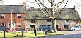 War Memorial, Memorial Green, Roade 3 February 2010 | |
 Roade Location within Northamptonshire | |
| Population | 2,254 (2001 census)[1][2] 2,312 (2011 census). |
| OS grid reference | SP755515 |
| • London | 66 miles (106 km) |
| Civil parish |
|
| District |
|
| Shire county |
|
| Region |
|
| Country | England |
| Sovereign state | United Kingdom |
| Post town | NORTHAMPTON |
| Postcode district | NN7 |
| Dialling code | 01604 |
| Police | Northamptonshire |
| Fire | Northamptonshire |
| Ambulance | East Midlands |
| EU Parliament | East Midlands |
| UK Parliament |
|
Roade is a village in Northamptonshire, England. It is represented by South Northamptonshire District Council, falling within the two-member Blisworth and Roade ward.
Contents
1 Location
2 Demographics
3 West Coast Main Line
3.1 1969 rail accident
4 Facilities
5 Famous people from the village
6 References
7 External links
Location
Roade straddles the busy Northampton to Milton Keynes A508, ca. 2 miles (3 km) south of junction 15 of the M1 motorway, 5 miles (8 km) south of Northampton and 12 miles (19 km) north of Milton Keynes. The road bisects the village into east, the older part, and west, which is mostly 20th-century housing.
Demographics
The 2001 Census[1] shows 2,254 people living in the parish, 1,117 male and 1,137 female, in 962 dwellings. In 2011 the population had increased to 2,312.[3]
West Coast Main Line

Roade cutting looking north from a pedestrian bridge with a Virgin Trains Pendolino travelling south on the fast lines with the Northampton loop lines on the right
Four tracks of the West Coast Main Line railway from London Euston to Manchester and Scotland go through the village in this deep cutting. The cutting bisects the village into the older part on the east side and the more recent west side. However, there are two main road bridges and four others for pedestrians, some for minor traffic and farm vehicles. The line dates from 1838 and was electrified in the 1960s. It now carries 125 mph trains.
The cutting is a geological Site of Special Scientific Interest (SSSI) listed by English Nature.[4]
A station serving Roade was situated at the southern end of the village and the cutting, but closed in 1964. The four lines split at the north end of the cutting with the two eastern lines forming the slower Northampton loop, and the other two fast lines heading directly for Rugby. There was a campaign in the 1990s to have the station re-opened for commuter traffic to London, Milton Keynes and Northampton but there are no current plans to add additional stops on the line.
1969 rail accident
An accident occurred at the northern end of the cutting, at the junction, on 31 December 1969 when a northbound goods train on the slow lines derailed. A southbound passenger train from Northampton was passing at the time at about 75 mph and collided with the derailed wagons and was partly de-railed itself. The driver of the passenger train was killed.[5] The cause of the derailment was the failure of a main bearing spring on an empty 16-ton mineral wagon and very similar to a previous incident on the Northampton loop in 1967.
Facilities
The local secondary school, Elizabeth Woodville School is the one of two Sports Colleges in Northamptonshire, the other being Kingsthorpe College. The school is on the A508 Stratford road at the south-west end of the village and has around 1,150 pupils.[6] The catchment area extends to Grange Park, Blisworth, Stoke Bruerne and several other villages in the area. The school opened in 1956 as Roade Secondary Modern School changing to a Comprehensive School in 1975.[7] The School merged with Kingsbrook Business and Enterprise school in Deanshanger in September 2011.[8] The merged school was renamed Elizabeth Woodville School. Woodville was born in Grafton Regis which is halfway between the two schools and was Queen consort of King Edward IV.
Roade Primary School in Hartwell Road has about 166 pupils[9] and the original school was built in 1876.
There is a main post office in the High Street offering most services including the payment of Vehicle Excise Duty.
The village pub is The Cock Inn, at the junction of the High Street with Hartwell Road.
The village has its own football team who play in the Premier Division of the Northamptonshire Combination Football League, known as Roade FC.
Famous people from the village
Glenys Kinnock, Labour party politician.[10]
References
^ ab "UK census 2001 - data". Retrieved 2 October 2008..mw-parser-output cite.citation{font-style:inherit}.mw-parser-output .citation q{quotes:"""""""'""'"}.mw-parser-output .citation .cs1-lock-free a{background:url("//upload.wikimedia.org/wikipedia/commons/thumb/6/65/Lock-green.svg/9px-Lock-green.svg.png")no-repeat;background-position:right .1em center}.mw-parser-output .citation .cs1-lock-limited a,.mw-parser-output .citation .cs1-lock-registration a{background:url("//upload.wikimedia.org/wikipedia/commons/thumb/d/d6/Lock-gray-alt-2.svg/9px-Lock-gray-alt-2.svg.png")no-repeat;background-position:right .1em center}.mw-parser-output .citation .cs1-lock-subscription a{background:url("//upload.wikimedia.org/wikipedia/commons/thumb/a/aa/Lock-red-alt-2.svg/9px-Lock-red-alt-2.svg.png")no-repeat;background-position:right .1em center}.mw-parser-output .cs1-subscription,.mw-parser-output .cs1-registration{color:#555}.mw-parser-output .cs1-subscription span,.mw-parser-output .cs1-registration span{border-bottom:1px dotted;cursor:help}.mw-parser-output .cs1-ws-icon a{background:url("//upload.wikimedia.org/wikipedia/commons/thumb/4/4c/Wikisource-logo.svg/12px-Wikisource-logo.svg.png")no-repeat;background-position:right .1em center}.mw-parser-output code.cs1-code{color:inherit;background:inherit;border:inherit;padding:inherit}.mw-parser-output .cs1-hidden-error{display:none;font-size:100%}.mw-parser-output .cs1-visible-error{font-size:100%}.mw-parser-output .cs1-maint{display:none;color:#33aa33;margin-left:0.3em}.mw-parser-output .cs1-subscription,.mw-parser-output .cs1-registration,.mw-parser-output .cs1-format{font-size:95%}.mw-parser-output .cs1-kern-left,.mw-parser-output .cs1-kern-wl-left{padding-left:0.2em}.mw-parser-output .cs1-kern-right,.mw-parser-output .cs1-kern-wl-right{padding-right:0.2em}
^ SNC. South Northamptonshire Council Year Book 2009-2010.
^ "Civil Parish population 2011". Neughbourhood Statistics. Office for National Statistics. Retrieved 9 July 2016.
^ English Nature site with details of Roade cutting
^ Report on the Derailment and subsequent Collision that occurred on 31 December 1969 near Roade Junction - official report of the accident, accessed 23 July 2011
^ Elizabeth Woodville School at the northamptonshire County Council website Archived 27 March 2012 at the Wayback Machine
^ A History of Roade, from Volume V of "A History of Northamptonshire" at British History Online
^ Northampton Chronicle & Echo, 13 June 2011
^ Roade Primary School at the Northamptonshire County Council website
^ "Spin profile of Glenys Kinnock". Retrieved 6 October 2009.
External links
![]() Media related to Roade at Wikimedia Commons
Media related to Roade at Wikimedia Commons
- Roade parish council web site
- Roade football club website
- Roade History Society


