Lage, North Rhine-Westphalia
Lage | |
|---|---|
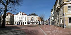 Market square | |
 Coat of arms | |
Location of Lage within Lippe district   | |
 Lage Show map of Germany  Lage Show map of North Rhine-Westphalia | |
| Coordinates: 51°58′0″N 8°48′0″E / 51.96667°N 8.80000°E / 51.96667; 8.80000Coordinates: 51°58′0″N 8°48′0″E / 51.96667°N 8.80000°E / 51.96667; 8.80000 | |
| Country | Germany |
| State | North Rhine-Westphalia |
| Admin. region | Detmold |
| District | Lippe |
| Government | |
| • Mayor | Christian Liebrecht (CDU) |
| Area [1] | |
| • Total | 76.04 km2 (29.36 sq mi) |
| Elevation | 100 m (300 ft) |
| Population (2017-12-31)[2] | |
| • Total | 35,166 |
| • Density | 460/km2 (1,200/sq mi) |
| Time zone | CET/CEST (UTC+1/+2) |
| Postal codes | 32779–32791 |
| Dialling codes | 05232 |
| Vehicle registration | LIP |
| Website | www.lage.de |
Lage (German pronunciation: [ˈlaːgə]) is a city in the Lippe district of North Rhine-Westphalia (German: Nordrhein-Westfalen), Germany, approximatively 8 km northwest of the administrative center Detmold. It has 35,099 inhabitants (2016)[3]. The coat of arms of Lage depicts a farmer's plough. The city is not far from the Teutoburg Forest (German: Teutoburger Wald). Due to its convenient location Lage developed into a traffic hub in the former Principality of Lippe, today's district of Lippe.
Contents
1 History[4]
2 Twin towns
3 References
4 External links
History[4]
Numerous finds indicate a colonization of the location since the Neolithic times (2400 to 1800 b.c.).
Around 900 a.d. the parish church of St. Johann (today's Marktkirche) has been founded on a hillhock at the river Werre and is the origin of today's city Lage. In 1274, Lage is mentioned the first time in a document for the life annuity of the local clergy by the sentence "Jordanus plebanis in Lagis". In 1539, with the election of the first mayor self-administration rights are provable.
In 1843, borough rights were awarded by ruler Leopold II, Prince of Lippe. In the years after 1880 the construction of the railway lines Herford to Detmold (1880) and Bielefeld to Lemgo (1893) connects Lage with the surrounding cities by train and creates an interchange station.
During World War I (1914-1918) the hospital serves as a military hospital. In the city were housed parts of the Infantry Regiment 67. On 9 January 1933, Adolf Hitler spoke on a central square (Jahnplatz) in Lage. During World War II (1939-1945) several attacks by Allied bombers hit the center of Lage, causing over 60 casualties in the local population and destroying many houses.
In 1970, the city has been joined together to a large community with 32,000 residents with the surrounding communities Billinghausen, Ehrentrup, Hagen, Hardissen, Hedderhagen, Heiden, Heßloh, Horste, Kachtenhausen / Wellentrup, Müssen, Ohrsen, Pottenhausen, Stapelage, Waddenhausen and Wissentrup due to a local government reorganization.
Twin towns
 Horsham, West Sussex, England
 St Johann im Pongau, Salzburg, Austria
References
^ "Alle politisch selbständigen Gemeinden mit ausgewählten Merkmalen am 31.12.2018 (4. Quartal)". DESTATIS. Archived from the original on 10 March 2019. Retrieved 10 March 2019..mw-parser-output cite.citation{font-style:inherit}.mw-parser-output .citation q{quotes:"""""""'""'"}.mw-parser-output .citation .cs1-lock-free a{background:url("//upload.wikimedia.org/wikipedia/commons/thumb/6/65/Lock-green.svg/9px-Lock-green.svg.png")no-repeat;background-position:right .1em center}.mw-parser-output .citation .cs1-lock-limited a,.mw-parser-output .citation .cs1-lock-registration a{background:url("//upload.wikimedia.org/wikipedia/commons/thumb/d/d6/Lock-gray-alt-2.svg/9px-Lock-gray-alt-2.svg.png")no-repeat;background-position:right .1em center}.mw-parser-output .citation .cs1-lock-subscription a{background:url("//upload.wikimedia.org/wikipedia/commons/thumb/a/aa/Lock-red-alt-2.svg/9px-Lock-red-alt-2.svg.png")no-repeat;background-position:right .1em center}.mw-parser-output .cs1-subscription,.mw-parser-output .cs1-registration{color:#555}.mw-parser-output .cs1-subscription span,.mw-parser-output .cs1-registration span{border-bottom:1px dotted;cursor:help}.mw-parser-output .cs1-ws-icon a{background:url("//upload.wikimedia.org/wikipedia/commons/thumb/4/4c/Wikisource-logo.svg/12px-Wikisource-logo.svg.png")no-repeat;background-position:right .1em center}.mw-parser-output code.cs1-code{color:inherit;background:inherit;border:inherit;padding:inherit}.mw-parser-output .cs1-hidden-error{display:none;font-size:100%}.mw-parser-output .cs1-visible-error{font-size:100%}.mw-parser-output .cs1-maint{display:none;color:#33aa33;margin-left:0.3em}.mw-parser-output .cs1-subscription,.mw-parser-output .cs1-registration,.mw-parser-output .cs1-format{font-size:95%}.mw-parser-output .cs1-kern-left,.mw-parser-output .cs1-kern-wl-left{padding-left:0.2em}.mw-parser-output .cs1-kern-right,.mw-parser-output .cs1-kern-wl-right{padding-right:0.2em}
^ "Bevölkerung der Gemeinden Nordrhein-Westfalens am 31. Dezember 2017" (in German). Landesbetrieb Information und Technik NRW. Retrieved 2018-09-21.
^ "IT.NRW – Publikationsservice: Detailinfo". webshop.it.nrw.de. Retrieved 2018-07-24.
^ Lage, Stadt. "Geschichtliche Entwicklung / Stadt Lage". www.lage.de (in German). Retrieved 2018-07-24.
External links
Official website (in German)
Towns and municipalities in Lippe | ||
|---|---|---|
| ||
Authority control |
|
|---|
This Lippe district location article is a stub. You can help Wikipedia by expanding it. |


