Taedong River
| Taedong River | |
|---|---|
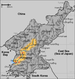 Map of the Taedong River | |
| Location | |
| Country |  Democratic People's Republic of Korea Democratic People's Republic of Korea |
| Physical characteristics | |
| Source | |
| - location | Rangrim Mountains, South Hamgyong |
| Mouth | |
- location | West Korea Bay |
| Length | 439 kilometers (273 mi)[1] |
| Basin size | 20,344 km2 (7,855 sq mi) |
| Taedong River | |
| Chosŏn'gŭl | 대동강 |
|---|---|
| Hancha | 大同江 |
| Revised Romanization | Daedong-gang |
| McCune–Reischauer | Taedong-gang |
The Taedong River (Chosŏn'gŭl: 대동강)[a] is a large river in the North Korea. It rises in the Rangrim Mountains of the country's north. It then flows southwest into Korea Bay at Namp'o.[3] In between, it runs through the country's capital, Pyongyang. Along the river are landmarks such as the Juche Tower and Kim Il-sung Square.
The river is 439 km in length, and generally is deep. It is the fifth-longest river on the Korean peninsula and the second-longest in North Korea. Pyongyang is approximately 110 km upstream from the mouth, Sunchon 192 km upstream, and Taehŭng 414 km upstream.[citation needed] Because of its depth, it is widely used for river transport; it is navigable by large ships up to 65 km inland, although most commercial traffic stops at Songrim.
Contents
1 History
2 Dams and bridges
3 Gallery
4 Notes
5 References
5.1 Citations
5.2 Bibliography
6 See also
History
The kingdom of Koguryo was founded on its shores. Many archeological sites dating to the neolithic and Bronze ages have been found along the river, as well as relics and ruins from Koguryo. It was also once known as the Pae River (패수; 浿水; P’aesu).[4]
Dams and bridges
In 1986, the government completed the 8-km-long West Sea Barrage, with three locks and 36 sluices, at the mouth of the Taedong River near Namp'o.[3] The dam acts to control floodwater and to irrigate lands newly reclaimed from the Korea Gulf.[3] The dam has reduced the river's natural ability to purify itself and tends to concentrate contaminants.[5] Other dams, such as the Nyongwon Power Station, have been built to provide energy to the country.[6]
In Pyongyang, there are six bridges on the Taedong, including the Okryu Bridge, Rungra Bridge, and Taedong Bridge.[7]
Gallery

Yanggakdo, Pyongyang

The Taedong River in Pyongyang

Taedong River in 1889
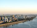
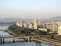

Grand People's Study House
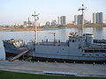
USS Pueblo on the Taedong

Taedong River in Nampho

Taedong River in Nampho


Notes
^ In the 19th century, the Taedong was spelled Tai-tang in Western texts (the "Tai-tang River" or "Tai-tang Kang").[2]
References
Citations
^ "Encyclopædia Britannica Online : Taedong River". Encyclopædia Britannica..mw-parser-output cite.citation{font-style:inherit}.mw-parser-output .citation q{quotes:"""""""'""'"}.mw-parser-output .citation .cs1-lock-free a{background:url("//upload.wikimedia.org/wikipedia/commons/thumb/6/65/Lock-green.svg/9px-Lock-green.svg.png")no-repeat;background-position:right .1em center}.mw-parser-output .citation .cs1-lock-limited a,.mw-parser-output .citation .cs1-lock-registration a{background:url("//upload.wikimedia.org/wikipedia/commons/thumb/d/d6/Lock-gray-alt-2.svg/9px-Lock-gray-alt-2.svg.png")no-repeat;background-position:right .1em center}.mw-parser-output .citation .cs1-lock-subscription a{background:url("//upload.wikimedia.org/wikipedia/commons/thumb/a/aa/Lock-red-alt-2.svg/9px-Lock-red-alt-2.svg.png")no-repeat;background-position:right .1em center}.mw-parser-output .cs1-subscription,.mw-parser-output .cs1-registration{color:#555}.mw-parser-output .cs1-subscription span,.mw-parser-output .cs1-registration span{border-bottom:1px dotted;cursor:help}.mw-parser-output .cs1-ws-icon a{background:url("//upload.wikimedia.org/wikipedia/commons/thumb/4/4c/Wikisource-logo.svg/12px-Wikisource-logo.svg.png")no-repeat;background-position:right .1em center}.mw-parser-output code.cs1-code{color:inherit;background:inherit;border:inherit;padding:inherit}.mw-parser-output .cs1-hidden-error{display:none;font-size:100%}.mw-parser-output .cs1-visible-error{font-size:100%}.mw-parser-output .cs1-maint{display:none;color:#33aa33;margin-left:0.3em}.mw-parser-output .cs1-subscription,.mw-parser-output .cs1-registration,.mw-parser-output .cs1-format{font-size:95%}.mw-parser-output .cs1-kern-left,.mw-parser-output .cs1-kern-wl-left{padding-left:0.2em}.mw-parser-output .cs1-kern-right,.mw-parser-output .cs1-kern-wl-right{padding-right:0.2em}
^ EB (1878), p. 390.
^ abc Suh, Dae-Sook (1987) "North Korea in 1986: Strengthening the Soviet Connection" Asian Survey 27(1): pp. 56-63, page 62
^ (1973) Transactions of the Korea branch of the Royal Asiatic Society. vol. 48, page 59
^ Tenenbaum, David J. (2005) "International Health: North Korean Catastrophe" Environmental Health Perspectives 113(1): p. A26, page A26
^ (209) Korea Today No. 640[permanent dead link]
^ "옥류교 [Okryu Bridge]", Doosan Encyclopedia, retrieved 2010-07-02
[permanent dead link]
Bibliography
, , New York: Charles Scribner's Sons, 1878, pp. 390–394.
See also
 | Wikimedia Commons has media related to Taedong River. |

- Taedong River estuary Important Bird Area
Taedonggang, a beer named after the river- List of Korea-related topics
- Rivers of Asia
- Rivers of Korea
- Geography of North Korea
Coordinates: 38°51′54″N 125°31′32″E / 38.86500°N 125.52556°E / 38.86500; 125.52556


