Little Kanawha River
| Little Kanawha River | |
|---|---|
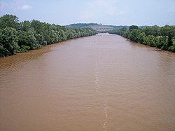 The Little Kanawha River just upstream of its mouth in Parkersburg | |
| Country | United States |
| Physical characteristics | |
| Main source | Upshur County, West Virginia |
| River mouth | Ohio River, Parkersburg, West Virginia |
| Length | 169 mi (272 km) |
| Basin features | |
| Basin size | 2,320 sq mi (6,000 km2) |


The Little Kanawha River in Glenville
The Little Kanawha River is a tributary of the Ohio River, 169 mi (269 km) long,[1] in western West Virginia in the United States. Via the Ohio, it is part of the watershed of the Mississippi River, draining an area of 2,320 mi² (6,009 km²)[2] on the unglaciated portion of the Allegheny Plateau. It served as an important commercial water route in the early history of West Virginia, particularly in the logging and petroleum industries.[1][3]
Contents
1 Course
2 Tributaries
3 Name
4 See also
5 External links
6 References
Course
The Little Kanawha rises in southern Upshur County, approximately 20 mi (32 km) south of Buckhannon. It follows a meandering course generally west-northwestwardly, through Lewis, Braxton, Gilmer, Calhoun, Wirt and Wood Counties, past the communities of Burnsville, Stouts Mills, Sand Fork, Glenville, Grantsville, Bigbend, Creston, Burning Springs, Palestine, Elizabeth, and Newark, to its mouth at the Ohio River in Parkersburg.[4]
About 3 mi (5 km) upstream of Burnsville,[5] a U.S. Army Corps of Engineers dam causes the river to form Burnsville Lake, which was completed in 1976 at a cost of $56.2 million.[6]
Tributaries
Along its course the Little Kanawha River collects the Right Fork Little Kanawha River on the boundary of Lewis and Braxton counties; Saltlick Creek and Oil Creek in Braxton County; Sand Fork, Cedar Creek and Leading Creek in Gilmer County; Steer Creek in Calhoun County; the West Fork Little Kanawha River, Spring Creek, Reedy Creek, and the Hughes River (its largest tributary)[1] in Wirt County; and Walker Creek, Tygart Creek, and Worthington Creek in Wood County.[4]
Additionally, a minor tributary near Grantsville is known as the Bull River; despite being named a "river," it is no larger than dozens of other small streams that flow into the Little Kanawha.[4]
Name
The Little Kanawha River was named for its smaller size relative to the nearby Kanawha River.[7]
According to the Geographic Names Information System, the Little Kanawha River has also been known as:[8]
|
|
|
See also
- Kanawha River
- List of rivers of West Virginia
- Burnsville Bridge
- Duck Run Cable Suspension Bridge
- Glenville Truss Bridge
- Stouts Mill Bridge
External links
- United States Environmental Protection Agency, watershed profile for Little Kanawha River
- Local Little Kanawha River history on rootsweb.com
References
^ abc Gilchrist-Stalnaker, Joy Gregoire. 2006. "Little Kanawha River." The West Virginia Encyclopedia. Ken Sullivan, editor. Charleston, WV: West Virginia Humanities Council. .mw-parser-output cite.citation{font-style:inherit}.mw-parser-output q{quotes:"""""""'""'"}.mw-parser-output code.cs1-code{color:inherit;background:inherit;border:inherit;padding:inherit}.mw-parser-output .cs1-lock-free a{background:url("//upload.wikimedia.org/wikipedia/commons/thumb/6/65/Lock-green.svg/9px-Lock-green.svg.png")no-repeat;background-position:right .1em center}.mw-parser-output .cs1-lock-limited a,.mw-parser-output .cs1-lock-registration a{background:url("//upload.wikimedia.org/wikipedia/commons/thumb/d/d6/Lock-gray-alt-2.svg/9px-Lock-gray-alt-2.svg.png")no-repeat;background-position:right .1em center}.mw-parser-output .cs1-lock-subscription a{background:url("//upload.wikimedia.org/wikipedia/commons/thumb/a/aa/Lock-red-alt-2.svg/9px-Lock-red-alt-2.svg.png")no-repeat;background-position:right .1em center}.mw-parser-output .cs1-subscription,.mw-parser-output .cs1-registration{color:#555}.mw-parser-output .cs1-subscription span,.mw-parser-output .cs1-registration span{border-bottom:1px dotted;cursor:help}.mw-parser-output .cs1-hidden-error{display:none;font-size:100%}.mw-parser-output .cs1-visible-error{font-size:100%}.mw-parser-output .cs1-subscription,.mw-parser-output .cs1-registration,.mw-parser-output .cs1-format{font-size:95%}.mw-parser-output .cs1-kern-left,.mw-parser-output .cs1-kern-wl-left{padding-left:0.2em}.mw-parser-output .cs1-kern-right,.mw-parser-output .cs1-kern-wl-right{padding-right:0.2em}
ISBN 0-9778498-0-5.
^ Willis, Todd C. (ed.) 1987. "Length of rivers and watershed areas in West Virginia." West Virginia Blue Book. Vol. 71.
^ "Little Kanawha once was vital transportation link," Parkersburg News & Sentinel website
^ abc DeLorme (1997). West Virginia Atlas & Gazetteer. Yarmouth, Maine: DeLorme.
ISBN 0-89933-246-3.
^ Burnsville Lake website, U.S. Army Corps of Engineers
^ Hohmann, George. "Lock offered combination for growth." Charleston Daily Mail. 15 June 1999. Archived 8 February 2005 at the Wayback Machine.
^ Kenny, Hamill (1945). West Virginia Place Names: Their Origin and Meaning, Including the Nomenclature of the Streams and Mountains. Piedmont, WV: The Place Name Press. p. 377.
^ U.S. Geological Survey Geographic Names Information System: Little Kanawha River
Coordinates: 39°15′55″N 81°34′08″W / 39.26535°N 81.56901°W / 39.26535; -81.56901


