Paythorne
| Paythorne | |
|---|---|
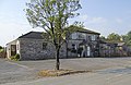
 Paythorne Methodist Chapel | |
 Paythorne Shown within Ribble Valley Show map of the Borough of Ribble Valley  Paythorne Paythorne shown within Lancashire Show map of Lancashire | |
| Population | 95 (2001 Census)[1] |
| OS grid reference | SD829519 |
| Civil parish |
|
| District |
|
| Shire county |
|
| Region |
|
| Country | England |
| Sovereign state | United Kingdom |
| Post town | CLITHEROE |
| Postcode district | BB7 |
| Dialling code | 01200 |
| Police | Lancashire |
| Fire | Lancashire |
| Ambulance | North West |
| EU Parliament | North West England |
| UK Parliament |
|
Paythorne is a small village and civil parish in Ribble Valley, Lancashire, England. It is situated alongside the River Ribble, north-east of Clitheroe, and on the boundary with North Yorkshire. Other parishes adjacent to Paythorne are Halton West, Nappa (both in North Yorkshire), Newsholme, Horton, Gisburn, Sawley, Bolton-by-Bowland and Gisburn Forest (all in Lancashire).[2] The nearest town is Barnoldswick, situated 7 kilometres (4.3 mi) south-east of the village.[3] Paythorne is on the edge of the Forest of Bowland Area of Outstanding Natural Beauty, although only a small area in the west of the parish is within the area's boundary.[2] The Ribble Way long distance walk passes through the village.[4]
Paythorne is a small village, with not many facilities although it has a pub (the Buck Inn) and a Methodist chapel. A mobile post office serves Gisburn; the nearest permanent Post Office is at Hellifield, 5 miles away. The area surrounding the village consists of several farms, and moorland including Paythorne Moor north of the village.
The village is mentioned in the Domesday Book in the 11th century. The meaning of the place name is uncertain, however suggestions have included "a thorn bush beside a pathway" and "a peacock shaped thorn bush".[5]Historically, Paythorne was in the West Riding of Yorkshire, and before it became a parish, it was a township in the parish of Gisburn.[6]
In the 2001 census, Paythorne had a population of 95,[1] however in 2011 the parish was grouped with Newsholme and Horton (2001 pop. 50 and 76), giving a total of 253.[7][2] From the 2011 Census population details had been included in Newsholme parish.
For local government, Paythorne is part of the ward of Gisburn, Rimington in the borough of Ribble Valley.[8]
The Pennine Bridleway National Trail and Ribble Way pass through the parish, crossing the Ribble on the Paythorne Bridge.
[9][10]
Media gallery
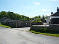
The Buck Inn

Paythorne Moor

Paythorne Bridge over the River Ribble
Ellenthorpe Farm in southwest of the parish (Thorp)

Carters Farmhouse


See also
| Wikimedia Commons has media related to Paythorne. |
- Listed buildings in Paythorne
References
^ ab "Parish headcount" (PDF). Lancashire Parish Portal. Lancashire County Council. Archived from the original (PDF) on 10 December 2006. Retrieved 2008-12-13..mw-parser-output cite.citation{font-style:inherit}.mw-parser-output .citation q{quotes:"""""""'""'"}.mw-parser-output .citation .cs1-lock-free a{background:url("//upload.wikimedia.org/wikipedia/commons/thumb/6/65/Lock-green.svg/9px-Lock-green.svg.png")no-repeat;background-position:right .1em center}.mw-parser-output .citation .cs1-lock-limited a,.mw-parser-output .citation .cs1-lock-registration a{background:url("//upload.wikimedia.org/wikipedia/commons/thumb/d/d6/Lock-gray-alt-2.svg/9px-Lock-gray-alt-2.svg.png")no-repeat;background-position:right .1em center}.mw-parser-output .citation .cs1-lock-subscription a{background:url("//upload.wikimedia.org/wikipedia/commons/thumb/a/aa/Lock-red-alt-2.svg/9px-Lock-red-alt-2.svg.png")no-repeat;background-position:right .1em center}.mw-parser-output .cs1-subscription,.mw-parser-output .cs1-registration{color:#555}.mw-parser-output .cs1-subscription span,.mw-parser-output .cs1-registration span{border-bottom:1px dotted;cursor:help}.mw-parser-output .cs1-ws-icon a{background:url("//upload.wikimedia.org/wikipedia/commons/thumb/4/4c/Wikisource-logo.svg/12px-Wikisource-logo.svg.png")no-repeat;background-position:right .1em center}.mw-parser-output code.cs1-code{color:inherit;background:inherit;border:inherit;padding:inherit}.mw-parser-output .cs1-hidden-error{display:none;font-size:100%}.mw-parser-output .cs1-visible-error{font-size:100%}.mw-parser-output .cs1-maint{display:none;color:#33aa33;margin-left:0.3em}.mw-parser-output .cs1-subscription,.mw-parser-output .cs1-registration,.mw-parser-output .cs1-format{font-size:95%}.mw-parser-output .cs1-kern-left,.mw-parser-output .cs1-kern-wl-left{padding-left:0.2em}.mw-parser-output .cs1-kern-right,.mw-parser-output .cs1-kern-wl-right{padding-right:0.2em}
^ abc "Wards and parishes map". MARIO. Lancashire County Council. Retrieved 1 March 2018.
^ "OpenStreetMap". Retrieved 2008-12-13.
^ Alan Shepley and Graham Wilkinson (2005). Walking the Ribble Way – A guide from sea to source. Wood Education Programme Trust. ISBN 978-0-9541809-1-1. OCLC 124023932.CS1 maint: Uses authors parameter (link)
^ "Parish Council Details: Paythorne Parish Council". Lancashire Parish Portal. Lancashire County Council. Retrieved 2008-12-13.
^ "Paythorne Tn/CP Yorkshire through time – Descriptive Gazetteer entries". A Vision of Britain through Time. University of Portsmouth & others. 2008. Retrieved 2008-12-14.
^ UK Census (2011). "Local Area Report – Newsholme Parish (1170215119)". Nomis. Office for National Statistics. Retrieved 1 March 2018.
^ The Borough of Ribble Valley (Electoral Changes) Order 2001. Office of Public Sector Information. 2001-07-13. ISBN 0-11-029681-8. Retrieved 2008-12-13.
^ MKH Computer Services Ltd. "Pennine Bridleway — LDWA Long Distance Paths". Ldwa.org.uk. Retrieved 7 April 2016.
^ MKH Computer Services Ltd. "Ribble Way — LDWA Long Distance Paths". Ldwa.org.uk. Retrieved 7 April 2016.
This Lancashire location article is a stub. You can help Wikipedia by expanding it. |


