Fishlake National Forest
| Fishlake National Forest | |
|---|---|
 Fishlake National Forest | |
 | |
| Location | Beaver, Garfield, Iron, Juab, Millard, Piute, Sanpete, Sevier, and Wayne counties, Utah, USA |
| Nearest city | Richfield, UT |
| Coordinates | 38°42′30″N 111°57′33″W / 38.70833°N 111.95917°W / 38.70833; -111.95917Coordinates: 38°42′30″N 111°57′33″W / 38.70833°N 111.95917°W / 38.70833; -111.95917[1] |
| Area | 1,461,226 acres (5,913.37 km2)[2] |
| Established | July 1, 1908[3] |
| Visitors | 500,000 (in 2006[4]) |
| Governing body | U.S. Forest Service |
| Website | Fishlake National Forest |
Fishlake National Forest is a U.S. National Forest located in south central Utah. The namesake for the forest is Fish Lake, the largest freshwater mountain lake in the state.[5]
Contents
1 Wildlife
2 Geography
3 Acquisition
4 Gallery
5 See also
6 References
7 External links
Wildlife
Animals that inhabit this forest are elk, shrews, deer, black bears, coyotes, various species of bats, moose, raccoons, two species of skunks, badgers, turkey vultures, two species of eagles, pika, snowshoe hares, various species of woodpeckers, pine marten, porcupines, four species of hummingbirds, beavers, kestrels, pronghorn, various species of owls, bobcats, minks, three species of fox, cougars, bighorn sheep, wild turkeys, and mountain goats.
Geography
Established in 1907, the forest covers 1.5 million acres (6,070 km²) and is split into four districts. The forest lies in parts of nine counties. In descending order of forestland area, they are Sevier, Millard, Piute, Beaver, Wayne, Juab, Garfield, Iron, and Sanpete counties. Forest headquarters are located in Richfield with local ranger district offices in Beaver, Fillmore, Loa, and Richfield.[6] The national forest is the headwaters of Otter Creek, a tributary of the East Fork Sevier River.
Pando, a clonal quaking aspen stand, that, according to some sources, is the oldest (80,000 years) and largest (106 acres, 13 million pounds) organism on Earth, is located in the Fremont River Ranger District of the National Forest, 1 mile southwest of Fish Lake on Utah route 25.[7]
Acquisition
Native water rights to Fish Lake were sold to the Fremont Irrigation Company on March 10, 1889 for nine horses, 500 pounds of flour, one steer, and a suit of clothes. Ten years later President William McKinley created a Forest Reserve which included Fish Lake.[8]

Fishlake National Forest map
Gallery

Quitchupah Canyon

State Route 72 in Fishlake National Forest
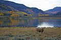
Fish Lake

Map of Fishlake National Forest in Millard County


See also
- List of U.S. national forests
- Fish Lake, Utah
- Fishlake Scenic Byway
References
^ "Fishlake National Forest". Geographic Names Information System. United States Geological Survey. Retrieved 2012-12-26..mw-parser-output cite.citation{font-style:inherit}.mw-parser-output .citation q{quotes:"""""""'""'"}.mw-parser-output .citation .cs1-lock-free a{background:url("//upload.wikimedia.org/wikipedia/commons/thumb/6/65/Lock-green.svg/9px-Lock-green.svg.png")no-repeat;background-position:right .1em center}.mw-parser-output .citation .cs1-lock-limited a,.mw-parser-output .citation .cs1-lock-registration a{background:url("//upload.wikimedia.org/wikipedia/commons/thumb/d/d6/Lock-gray-alt-2.svg/9px-Lock-gray-alt-2.svg.png")no-repeat;background-position:right .1em center}.mw-parser-output .citation .cs1-lock-subscription a{background:url("//upload.wikimedia.org/wikipedia/commons/thumb/a/aa/Lock-red-alt-2.svg/9px-Lock-red-alt-2.svg.png")no-repeat;background-position:right .1em center}.mw-parser-output .cs1-subscription,.mw-parser-output .cs1-registration{color:#555}.mw-parser-output .cs1-subscription span,.mw-parser-output .cs1-registration span{border-bottom:1px dotted;cursor:help}.mw-parser-output .cs1-ws-icon a{background:url("//upload.wikimedia.org/wikipedia/commons/thumb/4/4c/Wikisource-logo.svg/12px-Wikisource-logo.svg.png")no-repeat;background-position:right .1em center}.mw-parser-output code.cs1-code{color:inherit;background:inherit;border:inherit;padding:inherit}.mw-parser-output .cs1-hidden-error{display:none;font-size:100%}.mw-parser-output .cs1-visible-error{font-size:100%}.mw-parser-output .cs1-maint{display:none;color:#33aa33;margin-left:0.3em}.mw-parser-output .cs1-subscription,.mw-parser-output .cs1-registration,.mw-parser-output .cs1-format{font-size:95%}.mw-parser-output .cs1-kern-left,.mw-parser-output .cs1-kern-wl-left{padding-left:0.2em}.mw-parser-output .cs1-kern-right,.mw-parser-output .cs1-kern-wl-right{padding-right:0.2em}
^ "Land Areas of the National Forest System" (PDF). U.S. Forest Service. January 2012. Retrieved June 30, 2012.
^ "The National Forests of the United States" (PDF). ForestHistory.org. Archived from the original (PDF) on February 12, 2013. Retrieved July 30, 2012.
^ Staff (April 2010). "Utah Forest Highway Long Range Transportation Plan" (PDF). Central Federal Lands Highway Division. Archived from the original (PDF) on 16 September 2012. Retrieved 27 May 2012.
^ "About Us" - Fishlake National Forest
^ USFS Ranger Districts by State
^ "Pando". USDA Forest Service. Retrieved 2013-08-24.
^ "History of the Fishlake National Forest". USDA Forest Service web site. Retrieved 17 October 2011.
External links
| Wikimedia Commons has media related to Fishlake National Forest. |
- Fishlake National Forest - USDA Forest Service
- Fishlake National Forest - Utah Office of Tourism


