Destruction Bay
This article includes a list of references, but its sources remain unclear because it has insufficient inline citations. (July 2015) (Learn how and when to remove this template message) |
Destruction Bay | |
|---|---|
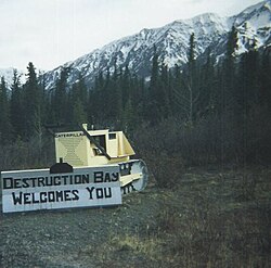 Welcome sign made on an old bulldozer | |
 Destruction Bay | |
| Coordinates: 61°15′15″N 138°48′24″W / 61.25417°N 138.80667°W / 61.25417; -138.80667Coordinates: 61°15′15″N 138°48′24″W / 61.25417°N 138.80667°W / 61.25417; -138.80667 | |
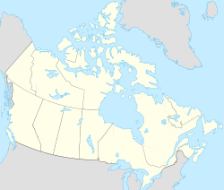
| Country | Canada |
| Territory | Yukon |
| Area [1] | |
| • Land | 13.57 km2 (5.24 sq mi) |
| Population (2016)[1] | |
| • Total | 55 |
| • Density | 4.1/km2 (11/sq mi) |
| Time zone | UTC-8 (Pacific (PST)) |
| • Summer (DST) | UTC-7 (PDT) |
Destruction Bay is a small community on the Alaska Highway (historical mile 1083) in Canada's Yukon on Kluane Lake. The population in 2001, according to the Census, was 43.[2] The population was 55 at the 2006 census. The population of Destruction Bay in 2011 has dropped to 35 people.[3] Most recently, the population increased by 57% to 55 individuals at the 2016 census.
Populated mostly by non-aboriginal residents, community residents provide Yukon government services to residents in the area (school, highway maintenance), including nearby Burwash Landing and some tourism-related businesses along the Alaska Highway. The name is derived from the wind blowing down structures erected by the military during highway construction in 1942–43.
The community has a one-room school serving kindergarten through grade eight.
References
^ ab "Census Profile". 2016 Census. Statistics Canada. Retrieved January 21, 2018..mw-parser-output cite.citation{font-style:inherit}.mw-parser-output .citation q{quotes:"""""""'""'"}.mw-parser-output .citation .cs1-lock-free a{background:url("//upload.wikimedia.org/wikipedia/commons/thumb/6/65/Lock-green.svg/9px-Lock-green.svg.png")no-repeat;background-position:right .1em center}.mw-parser-output .citation .cs1-lock-limited a,.mw-parser-output .citation .cs1-lock-registration a{background:url("//upload.wikimedia.org/wikipedia/commons/thumb/d/d6/Lock-gray-alt-2.svg/9px-Lock-gray-alt-2.svg.png")no-repeat;background-position:right .1em center}.mw-parser-output .citation .cs1-lock-subscription a{background:url("//upload.wikimedia.org/wikipedia/commons/thumb/a/aa/Lock-red-alt-2.svg/9px-Lock-red-alt-2.svg.png")no-repeat;background-position:right .1em center}.mw-parser-output .cs1-subscription,.mw-parser-output .cs1-registration{color:#555}.mw-parser-output .cs1-subscription span,.mw-parser-output .cs1-registration span{border-bottom:1px dotted;cursor:help}.mw-parser-output .cs1-ws-icon a{background:url("//upload.wikimedia.org/wikipedia/commons/thumb/4/4c/Wikisource-logo.svg/12px-Wikisource-logo.svg.png")no-repeat;background-position:right .1em center}.mw-parser-output code.cs1-code{color:inherit;background:inherit;border:inherit;padding:inherit}.mw-parser-output .cs1-hidden-error{display:none;font-size:100%}.mw-parser-output .cs1-visible-error{font-size:100%}.mw-parser-output .cs1-maint{display:none;color:#33aa33;margin-left:0.3em}.mw-parser-output .cs1-subscription,.mw-parser-output .cs1-registration,.mw-parser-output .cs1-format{font-size:95%}.mw-parser-output .cs1-kern-left,.mw-parser-output .cs1-kern-wl-left{padding-left:0.2em}.mw-parser-output .cs1-kern-right,.mw-parser-output .cs1-kern-wl-right{padding-right:0.2em}
^ "Population and Dwelling Counts" (PDF). Executive Council Office, Government of Yukon. May 2002. Archived from the original (PDF) on March 31, 2014.
^ Statistics Canada. Released October 24, 2012. "Destruction Bay, Yukon (Code 6001049) and Yukon, Yukon (Code 6001) (table)". Census Profile. 2011 Census. Statistics Canada Catalogue no. 98-316-XWE. Ottawa. Retrieved July 30, 2015.
External links
- Community Profile
- The Canadian Encyclopedia
- Hotels on Yellow Pages
- MapQuest
- AccuWeather
- RV Park Reviews
| Regions |
|
|---|---|
| Municipalities |
|
| Communities |
|
| Ghost towns |
|
| Parks |
|
| |
This article about a Yukon location is a stub. You can help Wikipedia by expanding it. |


