Gironès
Gironès | |
|---|---|
Comarca | |
 | |
| Country | |
| Autonomous community | |
| Province | Girona |
| Capital | Girona |
| Municipalities | List
|
| Government | |
| • President | Cristina Alsina i Conesa |
| Area | |
| • Total | 575.6 km2 (222.2 sq mi) |
| Population (2014) | |
| • Total | 185,085 |
| • Density | 320/km2 (830/sq mi) |
| Demonym(s) | Gironí |
| Time zone | UTC+1 (CET) |
| • Summer (DST) | UTC+2 (CEST) |
| Largest municipality | Girona |
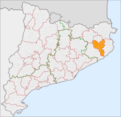
Gironès is a comarca (county) in eastern Catalonia, Spain, bordering Selva, Baix Empordà, Alt Empordà, Pla de l'Estany and Garrotxa. As of 2008[update], more than half of the comarca's 175,148 inhabitants live in the capital, Girona, which is also the capital of the province of Girona.
Municipalities
| Municipality | Population(2014)[1] | Areakm2[1] |
|---|---|---|
| Aiguaviva | 783 | 13.9 |
| Bescanó | 4,874 | 35.9 |
| Bordils | 1,690 | 7.3 |
| Campllong | 515 | 8.6 |
| Canet d'Adri | 644 | 44.4 |
| Cassà de la Selva | 9,922 | 45.2 |
| Celrà | 5,053 | 19.5 |
| Cervià de Ter | 934 | 9.9 |
| Flaçà | 1,041 | 6.5 |
| Fornells de la Selva | 2,479 | 11.9 |
| Girona | 97,227 | 39.1 |
| Juià | 340 | 8.4 |
| Llagostera | 8,198 | 76.4 |
| Llambilles | 738 | 14.6 |
| Madremanya | 283 | 13.7 |
| Medinyà | 852 | 7.7 |
| Quart | 3,441 | 38.1 |
| Salt | 30,103 | 6.6 |
| Sant Andreu Salou | 155 | 6.0 |
| Sant Gregori | 3,464 | 49.2 |
| Sant Joan de Mollet | 509 | 3.2 |
| Sant Jordi Desvalls | 708 | 11.7 |
| Sant Julià de Ramis | 2,582[2] | 11.1[2] |
| Sant Martí de Llémena | 626 | 43.1 |
| Sant Martí Vell | 242 | 17.5 |
| Sarrià de Ter | 4,937 | 4.2 |
| Vilablareix | 2,529 | 6.2 |
| Viladasens | 216 | 15.7 |
| • Total: 28 | 185,085 | 575.6 |
References and notes
^ ab "El municipi en xifres". Institut d'Estadística de Catalunya. Retrieved 2015-05-25..mw-parser-output cite.citation{font-style:inherit}.mw-parser-output .citation q{quotes:"""""""'""'"}.mw-parser-output .citation .cs1-lock-free a{background:url("//upload.wikimedia.org/wikipedia/commons/thumb/6/65/Lock-green.svg/9px-Lock-green.svg.png")no-repeat;background-position:right .1em center}.mw-parser-output .citation .cs1-lock-limited a,.mw-parser-output .citation .cs1-lock-registration a{background:url("//upload.wikimedia.org/wikipedia/commons/thumb/d/d6/Lock-gray-alt-2.svg/9px-Lock-gray-alt-2.svg.png")no-repeat;background-position:right .1em center}.mw-parser-output .citation .cs1-lock-subscription a{background:url("//upload.wikimedia.org/wikipedia/commons/thumb/a/aa/Lock-red-alt-2.svg/9px-Lock-red-alt-2.svg.png")no-repeat;background-position:right .1em center}.mw-parser-output .cs1-subscription,.mw-parser-output .cs1-registration{color:#555}.mw-parser-output .cs1-subscription span,.mw-parser-output .cs1-registration span{border-bottom:1px dotted;cursor:help}.mw-parser-output .cs1-ws-icon a{background:url("//upload.wikimedia.org/wikipedia/commons/thumb/4/4c/Wikisource-logo.svg/12px-Wikisource-logo.svg.png")no-repeat;background-position:right .1em center}.mw-parser-output code.cs1-code{color:inherit;background:inherit;border:inherit;padding:inherit}.mw-parser-output .cs1-hidden-error{display:none;font-size:100%}.mw-parser-output .cs1-visible-error{font-size:100%}.mw-parser-output .cs1-maint{display:none;color:#33aa33;margin-left:0.3em}.mw-parser-output .cs1-subscription,.mw-parser-output .cs1-registration,.mw-parser-output .cs1-format{font-size:95%}.mw-parser-output .cs1-kern-left,.mw-parser-output .cs1-kern-wl-left{padding-left:0.2em}.mw-parser-output .cs1-kern-right,.mw-parser-output .cs1-kern-wl-right{padding-right:0.2em}
^ ab Adjusted following loss of Medinyà in 2015
External links
Official comarcal web site (in Catalan)
Places adjacent to Gironès | ||||||||||
|---|---|---|---|---|---|---|---|---|---|---|
| ||||||||||
Coordinates: 41°56′11″N 2°48′22″E / 41.93639°N 2.80611°E / 41.93639; 2.80611


