Rondônia
State of Rondônia | |||
|---|---|---|---|
State | |||
| |||
 Location of State of Rondônia in Brazil | |||
| Coordinates: 10°54′S 62°46′W / 10.90°S 62.76°W / -10.90; -62.76Coordinates: 10°54′S 62°46′W / 10.90°S 62.76°W / -10.90; -62.76 | |||
| Country | |||
Capital and largest city | Porto Velho | ||
| Government | |||
| • Governor | Coronel Marcos Rocha (PSL) | ||
| • Vice Governor | Zé Jodan (PSL) | ||
| • Senators | Acir Gurgacz (PDT) Ivo Cassol (PP) Valdir Raupp (MDB) | ||
| Area | |||
| • Total | 237,576.16 km2 (91,728.67 sq mi) | ||
| Area rank | 13th | ||
| Population (2012)[1] | |||
| • Total | 1,590,011 | ||
| • Rank | 23rd | ||
| • Density | 6.7/km2 (17/sq mi) | ||
| • Density rank | 19th | ||
| Demonym(s) | Rondoniano or Rondoniense | ||
GDP | |||
| • Year | 2006 estimate | ||
| • Total | R$ 13,110,000,000 (22nd) | ||
| • Per capita | R$ 8,391 (15th) | ||
HDI | |||
| • Year | 2014 | ||
| • Category | 0.715 – high (18th) | ||
| Time zone | UTC-4 (BRT–1[2]) | ||
| Postal Code | 76800-000 to 76999-000 | ||
| ISO 3166 code | BR-RO | ||
| Website | rondonia.ro.gov.br | ||

Rondônia (Portuguese pronunciation: [ʁõˈdõniɐ][3]) is a state in Brazil, located in the northern part of the country. To the west is a short border with the state of Acre, to the north is the state of Amazonas, in the east is Mato Grosso, and in the south and southwest is Bolivia. Its capital is Porto Velho. The state was named after Cândido Rondon.[4]
Contents
1 Geography
2 Demographics
3 Native Brazilians
4 Transport
5 References
6 External links
Geography
Rondonia was originally home to over 200,000 km2 of rainforest, but has become one of the most deforested places in the Amazon. By 2003 around 70,000 km2 of rainforest had been cleared.[5]
The area around the Guaporé River is part of the Beni savanna ecoregion.[6]
The Samuel Dam is located in the state, on the Jamari River.[7]

Slash-and-burn farming in the state of Rondônia.

Madeira River.

Madeira River and Porto Velho.


Demographics
According to the IBGE of 2008, there were 1,519,000 people residing in the state. The population density was 6.6 inh./km².
Urbanization: 66.8% (2004); Population growth: 2.2% (1991-2000); Houses: 430,747 (2005).[8]
The last PNAD (National Research for Sample of Domiciles) census revealed the following numbers: 832,000 Brown (Multiracial) people (54.81%), 546,000 White people (35.95%), 115,000 Black people (7.56%), 16,000 Asian people (1.08%), 8,000 Amerindian people (0.53%).[9]
Native Brazilians

Indigenous Territories in Rondônia.
As of 2011[update] there were 21 Indigenous Territories in Rondônia, with two more in process of being demarcated.[10] The largest of these, the Uru-Eu-Wau-Wau Indigenous Territory, covers over 1.8 million hectares.[11] Another, the Rio Omerê Indigenous Territory, is home to the Kanoê and Akuntsu people, who number only four and five individuals respectively.[12][13]

Federal University of Rondônia in Porto Velho.
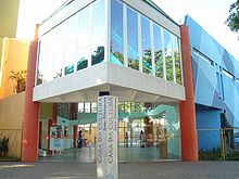
House of Culture Ivan Marrocos, in Porto Velho.
Transport

Porto Velho/Governador Jorge Teixeira de Oliveira International Airport.
Belmonte Airport is located in the state capital of Porto Velho.[14]
References
^ Ibge.gov
^ "Flag Current Local Time in Porto Velho, Rondônia, Brazil". Time and Date. Retrieved 15 August 2016..mw-parser-output cite.citation{font-style:inherit}.mw-parser-output q{quotes:"""""""'""'"}.mw-parser-output code.cs1-code{color:inherit;background:inherit;border:inherit;padding:inherit}.mw-parser-output .cs1-lock-free a{background:url("//upload.wikimedia.org/wikipedia/commons/thumb/6/65/Lock-green.svg/9px-Lock-green.svg.png")no-repeat;background-position:right .1em center}.mw-parser-output .cs1-lock-limited a,.mw-parser-output .cs1-lock-registration a{background:url("//upload.wikimedia.org/wikipedia/commons/thumb/d/d6/Lock-gray-alt-2.svg/9px-Lock-gray-alt-2.svg.png")no-repeat;background-position:right .1em center}.mw-parser-output .cs1-lock-subscription a{background:url("//upload.wikimedia.org/wikipedia/commons/thumb/a/aa/Lock-red-alt-2.svg/9px-Lock-red-alt-2.svg.png")no-repeat;background-position:right .1em center}.mw-parser-output .cs1-subscription,.mw-parser-output .cs1-registration{color:#555}.mw-parser-output .cs1-subscription span,.mw-parser-output .cs1-registration span{border-bottom:1px dotted;cursor:help}.mw-parser-output .cs1-hidden-error{display:none;font-size:100%}.mw-parser-output .cs1-visible-error{font-size:100%}.mw-parser-output .cs1-subscription,.mw-parser-output .cs1-registration,.mw-parser-output .cs1-format{font-size:95%}.mw-parser-output .cs1-kern-left,.mw-parser-output .cs1-kern-wl-left{padding-left:0.2em}.mw-parser-output .cs1-kern-right,.mw-parser-output .cs1-kern-wl-right{padding-right:0.2em}
^ In Brazilian Portuguese. The European Portuguese pronunciation is [ʁõˈdoniɐ].
^ Revkin, Andrew (2004-09-30). The Burning Season: The Murder of Chico Mendes and the Fight for the Amazon Rain Forest. Island Press. p. 118. ISBN 9781610913485.
^ "Amazon Deforestation". Earth Observatory. NASA. Retrieved 7 October 2012.
^ Robin Sears and Robert Langstroth. "Central South America: Northern Bolivia". Tropical and Subtropical Grasslands, Savannas and Shrublands. WWF. Retrieved 7 October 2012.
^ "Samuel Dam, Rondônia, Brazil". U.S. Geological Survey. 13 October 2011. Retrieved 26 January 2015.
^ Source: PNAD.
^ (PDF) (in Portuguese). Rondônia, Brazil: IBGE. 2008. ISBN 85-240-3919-1 http://www.sidra.ibge.gov.br/bda/tabela/listabl.asp?z=pnad&o=3&i=P&c=262. Retrieved 2010-01-18. Missing or empty|title=(help)
^ "Terras Indígenas: Pesquisa por Estado: Rondônia". Povos Indígenas no Brasil (in Portuguese). Instituto Socioambiental (ISA). Retrieved 24 March 2011.
^ "Caracterização Terra Indígena Uru-Eu-Wau-Wau". Povos Indígenas no Brasil (in Portuguese). Instituo Socioambiental (ISA). Retrieved 24 March 2011.
^ Instituto Socioambiental (ISA). "Introduction > Akuntsu". Povos Indígenas no Brasil. Retrieved 8 March 2011.
^ Instituto Socioambiental (ISA). "Introduction > Kanoê". Povos Indígenas no Brasil. Retrieved 8 March 2011.
^ "Porto Velho, Belmonte (PVH) information". theAirDB. Retrieved 1 January 2013.
External links
Rondôniaat Wikipedia's sister projects
 Definitions from Wiktionary
 Media from Wikimedia Commons
 News from Wikinews
 Quotations from Wikiquote
 Texts from Wikisource
 Textbooks from Wikibooks
 Travel guide from Wikivoyage
 Resources from Wikiversity
(in Portuguese) Official Website
- Rondonia Web
Capital: Porto Velho | ||
| Alvorada d'Oeste |
|  |
| Ariquemes |
| |
| Cacoal |
| |
| Colorado do Oeste |
| |
| Guajara-Mirim |
| |
| Ji-Parana |
| |
| Porto Velho |
| |
| Vilhena |
| |
| North |
|
|---|---|
| Northeast |
|
| Center-West |
|
| Southeast |
|
| South |
|
| |
Authority control |
|
|---|


