Potsdam, New York
Potsdam | |
|---|---|
Town | |
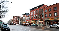 Market Street in the Village of Potsdam | |
| Motto(s): All Roads Lead to Potsdam | |
 Potsdam Location within the state of New York | |
| Coordinates: 44°40′15″N 74°59′3″W / 44.67083°N 74.98417°W / 44.67083; -74.98417Coordinates: 44°40′15″N 74°59′3″W / 44.67083°N 74.98417°W / 44.67083; -74.98417 | |
| Country | United States |
| State | New York |
| County | St. Lawrence |
| Area | |
| • Total | 103.4 sq mi (267.9 km2) |
| • Land | 101.5 sq mi (262.8 km2) |
| • Water | 2.0 sq mi (5.2 km2) |
| Elevation | 433 ft (132 m) |
| Population (2010) | |
| • Total | 15,741 |
| • Estimate (2016)[1] | 16,159 |
| • Density | 150/sq mi (59/km2) |
| Time zone | UTC-5 (Eastern (EST)) |
| • Summer (DST) | UTC-4 (EDT) |
| ZIP code | 13676 |
| Area code(s) | 315 Exchange: 265,267,268,742 |
| FIPS code | 36-59564 |
GNIS feature ID | 0977239 |
Potsdam is a town in St. Lawrence County, New York, United States. The town population was 17,029 at the 2010 census. The ZIP Code is 13676. Potsdam is a cultural and educational hub of Northern New York. When SUNY Potsdam and Clarkson University are in session, the population increases by approximately 8,000 students. The town is named after the city of Potsdam in Germany.
The Town of Potsdam also contains a village named Potsdam. Potsdam is centrally located within the county and northeast of Canton, the county seat.
Contents
1 History
2 Geography
3 Climate
4 Demographics
5 Local schools and universities
6 Communities and locations in Potsdam
7 Radio
8 Television
9 Notable people
10 Bibliography
11 References
12 External links
History

The town court for Potsdam
David Clarkson and Garret van Horn were early investors in the town, and settlement began around 1803. The newcomers found Native Americans residing in the town and in the fur trade.
The town was established in 1806 from part of the Town of Madrid. Potsdam is one of the original ten towns of St. Lawrence County.

Perspective map of Potsdam from 1885 with list of landmarks by L.R. Burleigh
The community of Potsdam set itself apart from the town in 1831 by incorporating as a village. The community of Raquetteville incorporated as the Village of Potsdam Junction (now Norwood) in 1871.
St. Lawrence Academy, the predecessor of the State University of New York at Potsdam was founded in 1816. In 1896, Clarkson University was founded.
The Potsdam area is well known for its reddish-orange Potsdam sandstone. A large slab of it is on display at the Smithsonian Institution in Washington, D.C.
The First Presbyterian Church of Dailey Ridge and French Family Farm are listed on the National Register of Historic Places.[2]
Geography
According to the United States Census Bureau, the town has an area of 103.4 square miles (267.9 km²), of which, 101.5 square miles (262.8 km²) of it is land and 2.0 square miles (5.2 km²) of it (1.92%) is water.
The Raquette River flows northward through the town's center. The Grasse River flows through the northwest part of Potsdam.
U.S. Route 11 and New York State Route 11B are east-west highways. New York State Route 56 is a north-south highway. New York State Route 345 is a northwest-southeast highway that intersects New York State Route 310 near the northwest town line.
Climate
| Climate data for Potsdam, New York | |||||||||||||
|---|---|---|---|---|---|---|---|---|---|---|---|---|---|
| Month | Jan | Feb | Mar | Apr | May | Jun | Jul | Aug | Sep | Oct | Nov | Dec | Year |
| Record high °F (°C) | 66 (19) | 65 (18) | 92 (33) | 89 (32) | 91 (33) | 95 (35) | 98 (37) | 99 (37) | 93 (34) | 91 (33) | 77 (25) | 70 (21) | 99 (37) |
| Average high °F (°C) | 26 (−3) | 30 (−1) | 39 (4) | 53 (12) | 66 (19) | 75 (24) | 79 (26) | 77 (25) | 70 (21) | 57 (14) | 45 (7) | 32 (0) | 54 (12) |
| Average low °F (°C) | 6 (−14) | 8 (−13) | 19 (−7) | 33 (1) | 44 (7) | 54 (12) | 59 (15) | 56 (13) | 48 (9) | 37 (3) | 28 (−2) | 15 (−9) | 34 (1) |
| Record low °F (°C) | −41 (−41) | −40 (−40) | −30 (−34) | −8 (−22) | 21 (−6) | 29 (−2) | 35 (2) | 28 (−2) | 22 (−6) | 5 (−15) | −9 (−23) | −37 (−38) | −41 (−41) |
| Average precipitation inches (mm) | 2.12 (54) | 1.89 (48) | 2.15 (55) | 2.93 (74) | 3.17 (81) | 3.45 (88) | 3.74 (95) | 3.75 (95) | 4.26 (108) | 4.11 (104) | 3.30 (84) | 2.54 (65) | 37.41 (950) |
| Source: The Weather Channel[3] | |||||||||||||
Demographics
| Historical population | |||
|---|---|---|---|
| Census | Pop. | %± | |
| 1820 | 1,911 | — | |
| 1830 | 3,650 | 91.0% | |
| 1840 | 4,473 | 22.5% | |
| 1850 | 5,349 | 19.6% | |
| 1860 | 6,737 | 25.9% | |
| 1870 | 7,774 | 15.4% | |
| 1880 | 7,610 | −2.1% | |
| 1890 | 8,939 | 17.5% | |
| 1900 | 9,054 | 1.3% | |
| 1910 | 8,726 | −3.6% | |
| 1920 | 8,794 | 0.8% | |
| 1930 | 8,880 | 1.0% | |
| 1940 | 9,609 | 8.2% | |
| 1950 | 12,437 | 29.4% | |
| 1960 | 14,045 | 12.9% | |
| 1970 | 16,700 | 18.9% | |
| 1980 | 17,911 | 7.3% | |
| 1990 | 16,822 | −6.1% | |
| 2000 | 15,957 | −5.1% | |
| 2010 | 15,741 | −1.4% | |
| Est. 2016 | 16,159 | [1] | 2.7% |
| U.S. Decennial Census[4] | |||
As of the census[5] of 2000, there were 15,957 people, 5,073 households, and 2,810 families residing in the town. The population density was 157.3 people per square mile (60.7/km²). There were 5,431 housing units at an average density of 53.5 per square mile (20.7/km²). The racial makeup of the town was 94.21% White, 1.59% Black or African American, 0.42% Native American, 2.53% Asian, 0.01% Pacific Islander, 0.36% from other races, and 0.88% from two or more races. Hispanic or Latino of any race were 1.25% of the population.
There were 5,073 households out of which 27.4% had children under the age of 18 living with them, 42.5% were married couples living together, 9.6% had a female householder with no husband present, and 44.6% were non-families. 31.8% of all households were made up of individuals and 11.4% had someone living alone who was 65 years of age or older. The average household size was 2.35 and the average family size was 2.97.
In the town, the population was spread out with 17.2% under the age of 18, 36.8% from 18 to 24, 19.9% from 25 to 44, 16.2% from 45 to 64, and 9.9% who were 65 years of age or older. The median age was 23 years. For every 100 females, there were 105.1 males. For every 100 females age 18 and over, there were 104.2 males.
The median income for a household in the town was $30,782, and the median income for a family was $42,450. Males had a median income of $32,464 versus $24,776 for females. The per capita income for the town was $23,753. About 13.0% of families and 23.1% of the population were below the poverty line, including 18.1% of those under age 18 and 9.9% of those age 65 or over.
Local schools and universities
The town of Potsdam consists of the Potsdam Central School District, which includes an elementary school (Lawrence Avenue), a middle school (A.A. Kingston), and a high school. The high school is the home of the Potsdam Sandstoners, or better known as the "Stoners."
All three of the local schools in Potsdam are under major renovation due to a large and complex New York State Capital Project. The project includes the reconstruction of the gym at the high school and major improvements to the parking situation at all three schools along with many more renovations/constructions. As of March 2008, the high school gym is nearing completion, the middle/elementary school parking lots are complete, new classrooms in the elementary school are nearing completion, and work has begun on renovations to the high school lobby/offices. The project also has an emphasis on safety with new security card access entries planned. The entire Capital Project is expected to cost 21.8 million dollars. Of this fee, 84% of the project will be paid for by New York State with only 16% of the fee coming from local tax payers (3.5 million).
Potsdam Central School Capital Project Timeline:
Public Vote: Wednesday December 14, 2005 (Approved)
Begin Design: January 2006
Design to NYS Dept. of Ed.: September 2006
Construction Start: April 2007
Construction Completion: September 2008
Official Link:
[1]
There are four Universities in the area, including SUNY Potsdam (which is known for its Crane School of Music) and Clarkson University (a private research university known for engineering and business) in Potsdam, as well as both St. Lawrence University and SUNY Canton in nearby Canton.
Communities and locations in Potsdam

Market Street in the village of Potsdam.
Bucks Bridge − A hamlet in the northwest corner of the town at the Grass River. The Buck's Bridge Community Church was listed on the National Register of Historic Places in 2004 as the Buck's Bridge United Methodist Church.[2]
Burnhams Corners − A location on NY-345 at County Road 35, northwest of Potsdam village.
Casey Corners − A location on County Road 34 in the west part of the town.
Clarkson University − A private university, southwest of Potsdam village.
Crary Mills − A hamlet.
Hewittville – A hamlet on the west bank of the Raquette River, north of Potsdam village.
Norwood − The south part of the Village of Norwood is by the north town line on NY-56. It was formerly called "Raquetteville" and "Potsdam Junction."
Norwood Reservoir – A reservoir southwest of Norwood.
Potsdam − The Village of Potsdam on the Raquette River.
Potsdam Municipal Airport - Damon Field (PTD) − A small airport east of Potsdam village.
Sissonville − A small hamlet on NY-56 north of Potsdam village.
Slab City − A location on County Road 35 is in the west part of the town and south of West Potsdam.
Stafford Corners − A location south of Potsdam village at the southeast town line.
SUNY Potsdam − A state college southeast of Potsdam village.
Sugar Island − A location in the Raquette River south of Potsdam village.
Unionville − A hamlet north of Potsdam village on NY-56. This is the site of one of the first cooperative settlements in New York.
West Potsdam − A hamlet on County Road 34 in the west part of the town, formerly known as "Smiths Corners."
Radio
WAIH "The Way" 90.3 FM waih.fm
1340 WMSA www.1340wmsa.com
WRCD-FM 101.5 The Fox www.1015thefox.com
WSNN-FM 99.3 [2] http://www.b993.fm
WTSC-FM 91.1 The Source [3]
WVLF-FM Mix 96.1 www.mymix961.com
Television
WNPI-DT, a full-power WPBS-TV rebroadcaster in South Colton, primarily serves Ottawa.
WWNY-CD, a low-power WWNY (CBS/Fox) retransmitter, is on WNPI's tower.
Notable people
Gigolo Aunts Alternative rock band that formed in Potsdam during the mid-1980s.
Lucinda Banister Chandler (1828-1911), social reformer and author
Craig Conroy Professional hockey player (retired)
Wes Craven Film director, educator and creator of the "Nightmare on Elm Street" and "Scream" series. Taught at Clarkson
John Gerrish Music professor and American composer
David A. Kyle Noted science fiction fan, author and publisher
Trevor Scott Pro football player
Jason Sutter Professional drummer, currently playing for Marilyn Manson
Jeff Thacher Percussionist of the band Rockapella
George A. Smith birthplace of this early leader of the Church of Jesus Christ of Latter-day Saints (Mormon).
Bibliography
Author Unknown (1894). Curtis, Gates (editor) (ed.). Our County and Its People: A Memorial Record of St. Lawrence County, New York. Syracuse, NY: D. Mason and Company.CS1 maint: Extra text: editors list (link).mw-parser-output cite.citation{font-style:inherit}.mw-parser-output .citation q{quotes:"""""""'""'"}.mw-parser-output .citation .cs1-lock-free a{background:url("//upload.wikimedia.org/wikipedia/commons/thumb/6/65/Lock-green.svg/9px-Lock-green.svg.png")no-repeat;background-position:right .1em center}.mw-parser-output .citation .cs1-lock-limited a,.mw-parser-output .citation .cs1-lock-registration a{background:url("//upload.wikimedia.org/wikipedia/commons/thumb/d/d6/Lock-gray-alt-2.svg/9px-Lock-gray-alt-2.svg.png")no-repeat;background-position:right .1em center}.mw-parser-output .citation .cs1-lock-subscription a{background:url("//upload.wikimedia.org/wikipedia/commons/thumb/a/aa/Lock-red-alt-2.svg/9px-Lock-red-alt-2.svg.png")no-repeat;background-position:right .1em center}.mw-parser-output .cs1-subscription,.mw-parser-output .cs1-registration{color:#555}.mw-parser-output .cs1-subscription span,.mw-parser-output .cs1-registration span{border-bottom:1px dotted;cursor:help}.mw-parser-output .cs1-ws-icon a{background:url("//upload.wikimedia.org/wikipedia/commons/thumb/4/4c/Wikisource-logo.svg/12px-Wikisource-logo.svg.png")no-repeat;background-position:right .1em center}.mw-parser-output code.cs1-code{color:inherit;background:inherit;border:inherit;padding:inherit}.mw-parser-output .cs1-hidden-error{display:none;font-size:100%}.mw-parser-output .cs1-visible-error{font-size:100%}.mw-parser-output .cs1-maint{display:none;color:#33aa33;margin-left:0.3em}.mw-parser-output .cs1-subscription,.mw-parser-output .cs1-registration,.mw-parser-output .cs1-format{font-size:95%}.mw-parser-output .cs1-kern-left,.mw-parser-output .cs1-kern-wl-left{padding-left:0.2em}.mw-parser-output .cs1-kern-right,.mw-parser-output .cs1-kern-wl-right{padding-right:0.2em}
"History and Pictures of Potsdam New York". Potsdam, NY 13676. Retrieved January 6, 2006.
References
^ ab "Population and Housing Unit Estimates". Retrieved June 9, 2017.
^ ab National Park Service (2009-03-13). "National Register Information System". National Register of Historic Places. National Park Service.
^ "Climate Statistics for Potsdam, NY". The Weather Channel. Retrieved March 29, 2012.
^ "Census of Population and Housing". Census.gov. Retrieved June 4, 2015.
^ "American FactFinder". United States Census Bureau. Retrieved 2008-01-31.
External links
- Potsdam Town Site
- Potsdam Village Site
Municipalities and communities of St. Lawrence County, New York, United States | ||
|---|---|---|
County seat: Canton | ||
| City |
|  |
| Towns |
| |
| Villages |
| |
| CDPs |
| |
| Hamlets |
| |


