Holston River
| Holston River | |
|---|---|
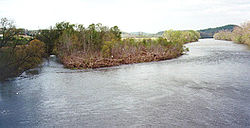 The North Fork of the Holston River near Weber City, Virginia. | |
 | |
| Location | |
| Country | United States |
| State | Virginia, Tennessee |
| Physical characteristics | |
| Source | North Fork Holston River |
| - location | Bland County, Virginia |
| - coordinates | 37°03′51″N 81°16′15″W / 37.06417°N 81.27083°W / 37.06417; -81.27083[1] |
| - elevation | 2,880 ft (880 m) |
| 2nd source | South Fork Holston River |
| - location | Smyth County, Virginia |
| - coordinates | 36°46′11″N 81°22′04″W / 36.76972°N 81.36778°W / 36.76972; -81.36778[2] |
| - elevation | 2,900 ft (880 m) |
| 3rd source | |
| - location | Kingsport, Tennessee |
| - coordinates | 36°32′51″N 82°36′44″W / 36.54750°N 82.61222°W / 36.54750; -82.61222[3] |
| - elevation | 1,158 ft (353 m) |
| Mouth | Tennessee River |
- location | Knoxville, Tennessee |
- coordinates | 35°57′33″N 83°51′0″W / 35.95917°N 83.85000°W / 35.95917; -83.85000Coordinates: 35°57′33″N 83°51′0″W / 35.95917°N 83.85000°W / 35.95917; -83.85000[3] |
- elevation | 814 ft (248 m)[3] |
| Length | 136 mi (219 km)[3] |
| Basin size | 3,776 sq mi (9,780 km2)[5] |
| Discharge | |
| - location | J. Will Taylor Bridge (Hwy. 70) near Knoxville, Tennessee, 5.5 miles (8.9 km) above the mouth(mean for water years 1931–1975, 1979-1983)[4] |
| - average | 4,759 cu ft/s (134.8 m3/s)(mean for water years 1931–1975, 1979-1983)[4] |
| - minimum | 44 cu ft/s (1.2 m3/s)December 1941[4] |
| - maximum | 62,900 cu ft/s (1,780 m3/s)March 1935[4] |
| Basin features | |
| River system | Tennessee → Ohio → Mississippi |
The Holston River is a 136-mile (219 km) river that flows from Kingsport, Tennessee, to Knoxville, Tennessee. Along with its three major forks (North Fork, Middle Fork and South Fork), it comprises a major river system that drains much of northeastern Tennessee, southwestern Virginia, and northwestern North Carolina. The Holston's confluence with the French Broad River at Knoxville marks the beginning of the Tennessee River.
The North Fork flows 138 miles (222 km) southwest from Sharon Springs in Bland County, Virginia. The Middle Fork flows 56.5 miles (90.9 km) from near the western border of Wythe County, Virginia, joining the South Fork in Washington County, Virginia, southeast of Abingdon. The South Fork rises near Sugar Grove in Smyth County and flows 112 miles (180 km) southwest to join the North Fork at Kingsport.[6] The Watauga River, a tributary of the South Fork Holston, flows 78.5 miles (126.3 km) westward from Watauga County, North Carolina.
The main stem of the Holston is impounded by the Tennessee Valley Authority's Cherokee Dam near Jefferson City, Tennessee. Five other dams, also managed by TVA, impound the Holston's headwater streams: Watauga Dam and Wilbur Dam on the Watauga River, and Boone Dam, Fort Patrick Henry Dam, and South Holston Dam, on the South Fork Holston River.
Contents
1 Power generation
2 Area
3 Name
4 Recreation
5 List of crossings
5.1 Holston River
5.2 South Fork Holston River
5.3 North Fork Holston River
5.4 Middle Fork Holston River
6 See also
7 References
8 External links
Power generation
The Holston River valley has been greatly developed for electrical power generation, both with hydroelectric dams and coal-fired steam plants. In the upper reaches, some of these plants are controlled by private interests; in the downstream portion, they are owned by the United States Government's Tennessee Valley Authority.
Area
Among the dams and associated reservoirs on the South Fork Holston River are Boone Dam and Boone Lake, named for the explorer Daniel Boone; Fort Patrick Henry Dam and Fort Patrick Henry Lake, named for the Revolutionary War hero; and South Holston Dam and South Holston Lake.
Cherokee Dam on the Holston River forms Cherokee Lake, named for the historic Native Americans who occupied extensive areas along the Holston River at the time of European-American settlement. The United States settlers and army fought with the Cherokee over land in Tennessee, North Carolina, and further South into Georgia and Alabama. In the 1830s the government forced the Cherokee out on the Trail of Tears to Indian Territory (now Oklahoma) west of the Mississippi River, under the authority of the Indian Removal Act passed by Congress in 1830.
Name
Maps by early French explorers in this area identified what is now known as the Holston River as the "Cherokee River", after the tribe they encountered. Early Tennessee historian and Tennessee Supreme Court Justice John Haywood cited in his 1823 book The civil and political history of the state of Tennessee from its earliest settlement up to the year 1796, including the boundaries of the state that the Holston River was identified and named on earlier produced French maps as the "Cherokee River".[7]
British colonists later named the Holston River after pioneer Stephen Holstein, a European-American settler who built a cabin in 1746 on the upper reaches of the river.[8] Similarly, Holston Mountain was named after the Holston River.
Recreation
All three forks in Virginia, South Holston Lake, and the Holston River in Tennessee below the South Holston Dam offer relatively easy-to-reach recreation opportunities. The North Fork in Virginia is known as an excellent smallmouth bass river (due to mercury contamination, fish caught in the North Fork of the Holston below Saltville, Virginia must not be consumed).[9] Both the South Fork in Virginia and the first 20 miles (32 km) of the Holston in Tennessee below South Holston Dam are quality brown trout and rainbow trout fisheries. The Holston River is wide and open enough to allow extensive fly fishing. South Holston Lake offers a variety of fishing opportunity as well, as it contains smallmouth bass, common carp, walleye, pike, sunfish, crappie and a few trout.
List of crossings
Holston River
The following is a list of major road crossings on the Holston River:
Bridge Name | Crossing/Road | Location | Notes |
| Boyds Bridge | Boyds Bridge Pike/Strawberry Plains Pike | Knoxville, Tennessee | First road crossing over the Holston |
| Holston River Bridge | Interstate 40 | Knoxville | |
| J.W. Will Taylor Memorial Bridge | Knoxville | ||
| Mascot Bridge | Mascot Road | Mascot/Strawberry Plains, Tennessee | Concrete arch bridge |
| John K. Shields Bridge | Near Jefferson City, Tennessee | ||
| Olen R. Marshall Bridge | Morristown/Bean Station, Tennessee | The Olen R. Marshall Bridge is one of two bridges to cross Cherokee Lake | |
| Melinda Ferry Bridge | near Rogersville, Tennessee | ||
| Hugh B. Day Bridge | near Rogersville and Persia, Tennessee | ||
| William L. Jenkins Bridge | location near Rogersville | ||
| Longs Bend Bridge | Longs Bend Pike | Surgoinsville, Tennessee | Original bridge was demolished in 2014. |
| Goshen Valley Road | Church Hill, Tennessee | Bridge does not have a name; final crossing over the main Holston River |
South Fork Holston River
North Fork Holston River
Middle Fork Holston River
See also
- List of Tennessee rivers
- List of Virginia rivers
- Watauga River
- Doe River
- Saltville, Virginia
References
^ U.S. Geological Survey Geographic Names Information System: North Fork Holston River
^ U.S. Geological Survey Geographic Names Information System: South Fork Holston River
^ abcd U.S. Geological Survey Geographic Names Information System: Holston River
^ abcd United States Geological Survey, Water Resources Data Tennessee: Water Year 1983, Water Data Report TN-83-1, p. 123.
^ U.S. Geological Survey, "Introduction to the Upper Tennessee River Basin," 11 January 2013. Accessed: 2 June 2015.
^ "Holston River - South Fork". Virginia Department of Game and Inland Fisheries..mw-parser-output cite.citation{font-style:inherit}.mw-parser-output .citation q{quotes:"""""""'""'"}.mw-parser-output .citation .cs1-lock-free a{background:url("//upload.wikimedia.org/wikipedia/commons/thumb/6/65/Lock-green.svg/9px-Lock-green.svg.png")no-repeat;background-position:right .1em center}.mw-parser-output .citation .cs1-lock-limited a,.mw-parser-output .citation .cs1-lock-registration a{background:url("//upload.wikimedia.org/wikipedia/commons/thumb/d/d6/Lock-gray-alt-2.svg/9px-Lock-gray-alt-2.svg.png")no-repeat;background-position:right .1em center}.mw-parser-output .citation .cs1-lock-subscription a{background:url("//upload.wikimedia.org/wikipedia/commons/thumb/a/aa/Lock-red-alt-2.svg/9px-Lock-red-alt-2.svg.png")no-repeat;background-position:right .1em center}.mw-parser-output .cs1-subscription,.mw-parser-output .cs1-registration{color:#555}.mw-parser-output .cs1-subscription span,.mw-parser-output .cs1-registration span{border-bottom:1px dotted;cursor:help}.mw-parser-output .cs1-ws-icon a{background:url("//upload.wikimedia.org/wikipedia/commons/thumb/4/4c/Wikisource-logo.svg/12px-Wikisource-logo.svg.png")no-repeat;background-position:right .1em center}.mw-parser-output code.cs1-code{color:inherit;background:inherit;border:inherit;padding:inherit}.mw-parser-output .cs1-hidden-error{display:none;font-size:100%}.mw-parser-output .cs1-visible-error{font-size:100%}.mw-parser-output .cs1-maint{display:none;color:#33aa33;margin-left:0.3em}.mw-parser-output .cs1-subscription,.mw-parser-output .cs1-registration,.mw-parser-output .cs1-format{font-size:95%}.mw-parser-output .cs1-kern-left,.mw-parser-output .cs1-kern-wl-left{padding-left:0.2em}.mw-parser-output .cs1-kern-right,.mw-parser-output .cs1-kern-wl-right{padding-right:0.2em}
^ John Haywood, The Civil and Political History of the State of Tennessee from Its Earliest Settlement up to the Year 1796, including the Boundaries of the State, 1823/reprinted 1891; available in full-text online at Internet Archive
^ Stewart, George R. (1967) [1945]. Names on the Land: A Historical Account of Place-Naming in the United States (Sentry edition (3rd) ed.). Houghton Mifflin.
^ "Holston River - North Fork". Virginia Department of Game and Inland Fisheries.
External links
| Wikimedia Commons has media related to Holston River. |
- U.S. Geological Survey Geographic Names Information System: Holston River


