Var (department)
Var | |||
|---|---|---|---|
Department of France | |||
 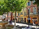 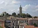  From top down, left to right: Massif de l'Esterel, Fréjus, Draguignan and Porquerolles | |||
| |||
 Location of Var in France | |||
| Coordinates: 43°30′N 06°20′E / 43.500°N 6.333°E / 43.500; 6.333Coordinates: 43°30′N 06°20′E / 43.500°N 6.333°E / 43.500; 6.333 | |||
| Country | France | ||
| Region | Provence-Alpes-Côte d'Azur | ||
| Prefecture | Toulon | ||
| Subprefectures | Brignoles Draguignan | ||
| Government | |||
| • President of the Departmental Council | Marc Giraud (LR) | ||
| Area 1 | |||
| • Total | 5,973 km2 (2,306 sq mi) | ||
| Population (2015) | |||
| • Total | 1,048,500 | ||
| • Rank | 22nd | ||
| • Density | 180/km2 (450/sq mi) | ||
| Time zone | UTC+1 (CET) | ||
| • Summer (DST) | UTC+2 (CEST) | ||
| Department number | 83 | ||
| Arrondissements | 3 | ||
| Cantons | 43 | ||
| Communes | 153 | ||
^1 French Land Register data, which exclude estuaries, and lakes, ponds, and glaciers larger than 1 km2 | |||


Var (French pronunciation: [vaʁ]) is a department in the Provence-Alpes-Côte d'Azur region in Southeastern France. It takes its name from the river Var, which flowed along its eastern boundary, until the boundary was moved in 1860. The Var department is bordered on the east by the department of Alpes-Maritimes, to the west by Bouches-du-Rhône, to the north of the river Verdon by the department of Alpes-de-Haute-Provence and to the south by the Mediterranean Sea.
Toulon is the largest city and administrative capital of Var. Other important towns in Var include Fréjus, Saint-Raphaël, Draguignan, Brignoles, Hyères and La Seyne-sur-Mer.
Var is known for the harbour of Toulon, the main port of the French Navy; for its seaside resorts, the most famous of which is Saint-Tropez; for some fine examples of Romanesque and medieval architecture, such as Le Thoronet Abbey and Fréjus Cathedral; and for its wines, particularly the wines of Bandol.
Contents
1 History
1.1 Early years
1.2 19th century
1.3 Recent times
2 Geography
3 Climate
4 Population
5 Economy
5.1 Tourism
5.2 Industry
5.3 Agriculture
5.3.1 Viticulture
6 See also
7 References
8 External links
History
Early years

Toulon, the historical capital city of Var, was returned that title in 1974.

Napoleon arriving in Fréjus, 1799
The department of Var was created at the time of the French Revolution, on 4 March 1790, from a portion of the former royal province of Provence. Its capital was originally Toulon, but this was moved to Grasse in 1793 to punish the Toulonnais for yielding the town to the British in 1793. Subsequently the capital was moved to Brignoles in 1795, then to Draguignan in 1797. It was not returned to Toulon until 1974.
19th century
In 1815, following the defeat of Napoleon at Waterloo the department was occupied by Austrian troops until November 1818. In 1854 the first railroad reached Toulon.
With the creation of the new department of Alpes-Maritimes in 1860 and following the annexation by France of Nice, the eastern part of the department, corresponding to the Arrondissement of Grasse, was moved to the new department. This move also shifted the river Var, which had given the department its name, to the new department.
In 1884 a cholera epidemic struck Toulon. The leader of the fight against the epidemic was Georges Clemenceau, a doctor and a member of the National Assembly for the Seine department. He was later elected a member of the National Assembly for the Var department from 1888 to 1893 and Senator from 1902 to 1920, during which time he also served as Prime Minister.
Recent times
The First World War (1914–1918) stimulated growth in shipyards and military industries in the region, but weakened the agricultural and food industries. In 1942 the German Army moved from Occupied France into the Zone libre, which included the Var department. The French Fleet was sabotaged in Toulon Harbour to keep it from falling into German hands.
The Maquis Vallier, a group of maquis resistance fighters, was active. On 15 August 1944 American and Free French forces land at Saint-Tropez, Sainte-Maxime and Saint-Raphaël. The Free French fleet arrived at Toulon on 13 September.
In the 1960s about one hundred thousand French citizens were repatriated from Algeria following the Algerian War of Independence and settled in the Var department.
Geography

Verdon Gorge

Îles d'Hyères
The department of Var has a surface area of 6,032 km2, and 420 km of coastline, including the offshore islands. 56% of it is covered with forest. Its geological formations are divided into two regions; one composed of limestone to the north-west of a line between Toulon and Draguignan; and of crystalline rock (quartz) to the south-east.
The department is in the foothills of the French Alps and largely mountainous. Major mountains include:
Massif des Maures (771 m) and Massif de l'Esterel, along the coast, (618 m) are made of quartz rock.- The Sainte-Baume mountain ridge, (1,147 m), in the west.
- Mountain of Lachens (1,715 m), in the northwest of the department, and the highest point in the Var.
The plateau of Canjuers (French: Plan de Canjuers) in the northeast of Var gradually rises from 500 to 1,000 metres. In the south and west there are several plateaus, such as the plateau of Siou Blanc to the north of Toulon, which rise from 400 to 700 metres in altitude.
- The Canyon du Verdon, the gorges of the Verdon River, is a popular place for hikers, kayakers, and nature lovers.
- The Îles d'Hyères (also known as Porquerolles) is a group of three islands off Hyères The islands are named Porquerolles, Port-Cros, and Île du Levant. Together, they make up an area of 26 km2. They can be reached by boat from either Hyères or Toulon.
Climate
The department of Var has a Mediterranean climate, slightly warmer, drier and sunnier than Nice and the Alpes-Maritimes, but also less sheltered from the wind. Toulon has an average of 2899.3 hours of sunshine each year.[1] The average maximum daily temperature in August is 29.1 °C, and the average daily minimum temperature in January is 5.8 °C.[1] The average annual rainfall is 665 mm.[1] Winds exceeding 16 m/s (57.6 km/h) blow an average of 116 days per year in Toulon,[1] compared with 77 days per year at Fréjus further east.[2]
Population
In 2007, the population of Var was estimated at 990,000, of whom nearly half live in and around Toulon.
In 2004–2005, the population of the urban area of Toulon was estimated at 403,743 persons, of whom 160,639 lived in Toulon itself: 60,188 in La Seyne-sur-Mer; 52,500 in Hyères; and 32,742 in Six-Fours-les-Plages.
The population of other important towns, according to the 2004–2005 estimate:
- Fréjus – 49,100
- Saint-Raphaël – 32,200
- Draguignan – 35,500
- Brignoles – 15,540
Economy
The principal industry of Var is tourism, thanks largely to the big summer influx of tourists to the Mediterranean coastal towns, and to the Verdon River Canyon and hilltop villages of Var.
Tourism

Bormes-les-Mimosas

Saint-Tropez
Popular tourist attractions in Var include:
- The port and beaches of Saint-Tropez
- The seaside village of Sainte-Maxime, with waterfront promenade, shops and restaurants, and a ferry service to Saint-Tropez.
- The beach of Cavalaire-sur-Mer, the longest sand beach on the coast.
- Boat tours of the Rade, or harbour, of Toulon, the main anchorage of the French Navy.
- Wind-surfing offshore of the peninsula of Giens
Le Thoronet Abbey, one of the best-preserved medieval Cistercian monasteries in France.- The Baptistery of Fréjus Cathedral, the oldest Christian structure in Provence.
- The hilltop village of Bormes-les-Mimosas
- The Îles d'Hyères, including the underwater natural park around the Ile de Port-Cros.
- Hiking in the Massif de l'Esterel
- The hilltop villages of Gassin, Ramatuelle, Montauroux, Fayence, Callian, Seillans, Tourrettes, Saint-Paul-en-Forêt, Mons and Tanneron in the Fayence region.
- The Canyon du Verdon, Lac de Sainte-Croix, and the hilltop villages of the upper Var.
- The hilltop villages, wine caves and vinyards near Bandol.
Industry
The construction industry employs 28,000 workers in the Var of which 4,000 work alone and 4,500 companies employ the remaining 24,000 salaried workers. Industry generates an annual turnover of €2.5 billion. Of this, €500 million is derived from public works.[3]
Agriculture
800 km2 or 13% of the total area is dedicated to agriculture, on which 40,000 people (14% of the Var working population) depend for their livelihoods. The department also has 10 km2 of horticultural land (of which 4 km2 are covered). Var is France's largest grower of cut flowers, producing some 500 million stems a year. Livestock farming is mainly sheep (50,000) and goats (4,200). Vines and viticultural related activities account for 345 km2 of farmland. The 450 domaines or coopératives and the 4 AOCs (appellation d'origine contrôlée) produce 150 million litres of wine a year. Var leads the world in the production of rose wine.
Other important agricultural products include olives (cultivated on 42 km2 of land—a quarter of all French olive groves—and processed in 40 mills), figs (the Var produces 80% of France's figs), and honey (800 tonnes per year). There are also 9 km2 of market gardens.
Agricultural turnover in Var is €610 million per year, of which 45% is sales of wines and 42% of horticultural products.[4]
In 2008 the Var department received approximately €15 million in farm subsdies under the EU Common Agriculture Policy, an average of about €6,000 per recipient farm. This compares with an average across France as a whole of over €18,000 per farm.[5]
Viticulture
- AOC Coteaux varois en Provence is a recent appellation d'origine contrôlée in Provence. The name Coteaux Varois was first used in 1945, and became an AOC in 1993. the name was changed to Couteaux Varois en Provence in 2005. The red wines principally use the grenache, cinsaut, mourvèdre and syrah grapes. White wines use the clairette, grenache blanc, rolle blanc, Sémillon Blanc, and Ugni Blanc. There are 22 km2 in this AOL. It produces 80% rosés, 17% red wines, and 3% white wines.
Bandol AOC, is grown on the coast west of Toulon, mostly around the villages of La Cadière-d'Azur and Castellet. Wines of this appellation must have at least 50% Mourvèdre grapes, though most have considerably more.[citation needed] Other grapes used are Grenache, Cinsault Syrah and Carignan.
See also
- Arrondissements of the Var department
- Cantons of the Var department
- Communes of the Var department
References
^ abcd infoclimat.fr precipitations a Toulon.
^ infoclimat.fr precipitations a Fréjus.
^ Var Matin. Monday 9 June 2008.
^ Var Matin and Le Magazin du Conseil général du Var.
^ farmsubsidy.org.
External links
Var at Curlie
(in French) Website of the General Council – The department's governing body
(in French) toulon.org – Many photographs cities and Var tourism guide
(in French) www.toulonnais.com – The monuments, the past, the plans of the city of Toulon. Many photographs inside
(in French) Life In Toulon
Authority control |
|
|---|


