Mogheul
Mogheul ﻣﻮﻏﻞ | |
|---|---|
Commune and town | |
 Location of Mogheul commune within Béchar Province | |
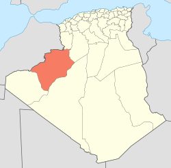
 Mogheul Location of Mogheul within Algeria | |
| Coordinates: 32°1′21″N 2°13′5″W / 32.02250°N 2.21806°W / 32.02250; -2.21806Coordinates: 32°1′21″N 2°13′5″W / 32.02250°N 2.21806°W / 32.02250; -2.21806 | |
| Country | |
| Province | Béchar Province |
| District | Lahmar District |
| Area [1] | |
| • Total | 640 km2 (250 sq mi) |
| Elevation | 1,026 m (3,366 ft) |
| Population (2008)[2] | |
| • Total | 635 |
| • Density | 0.99/km2 (2.6/sq mi) |
| Time zone | UTC+1 (CET) |
Mogheul (Arabic: ﻣﻮﻏﻞ) is a town and commune in Lahmar District, Béchar Province, in western Algeria near the border with Morocco. According to the 2008 census its population is 635,[2] down from 682 in 1998,[3] with an annual growth rate of -0.7%, the lowest in the province.[2] The commune covers an area of 640 square kilometres (250 sq mi), making it the smallest by area in the province.[1]
Contents
1 Geography
2 Climate
3 Economy
4 Infrastructure and housing
5 Transportation
6 Education
7 Health
8 Religion
9 Localities
10 References
Geography
Mogheul lies at an elevation of 1,026 metres (3,366 ft) on a plateau crossed by ranges of rocky hills. Small ranges rising about 100 metres (330 ft) above the surrounds are found quite nearby the town to the north and south; higher ranges are found further to the northeast and further south.
Climate
Mogheul has a hot desert climate (Köppen climate classification BWh), with very hot summers and cool winters. Precipitation is generally light, although due to Mogheul's high altitude and latitude it does receive somewhat more rain than other locations in Béchar Province. Summers are particularly dry.
| Climate data for Mogheul | |||||||||||||
|---|---|---|---|---|---|---|---|---|---|---|---|---|---|
| Month | Jan | Feb | Mar | Apr | May | Jun | Jul | Aug | Sep | Oct | Nov | Dec | Year |
| Average high °C (°F) | 14.5 (58.1) | 17.5 (63.5) | 20.3 (68.5) | 24.7 (76.5) | 30.4 (86.7) | 33.9 (93) | 38.7 (101.7) | 37.7 (99.9) | 32.4 (90.3) | 25.6 (78.1) | 19.1 (66.4) | 14.9 (58.8) | 25.8 (78.5) |
| Daily mean °C (°F) | 8.0 (46.4) | 10.4 (50.7) | 13.4 (56.1) | 17.4 (63.3) | 23.2 (73.8) | 26.6 (79.9) | 30.9 (87.6) | 30.3 (86.5) | 25.3 (77.5) | 19.1 (66.4) | 12.8 (55) | 8.4 (47.1) | 18.8 (65.9) |
| Average low °C (°F) | 1.5 (34.7) | 3.4 (38.1) | 6.6 (43.9) | 10.1 (50.2) | 16.0 (60.8) | 19.3 (66.7) | 23.1 (73.6) | 22.9 (73.2) | 18.2 (64.8) | 12.6 (54.7) | 6.6 (43.9) | 1.9 (35.4) | 11.9 (53.3) |
| Average precipitation mm (inches) | 14 (0.6) | 13 (0.5) | 16 (0.6) | 14 (0.6) | 9 (0.4) | 5 (0.2) | 2 (0.1) | 5 (0.2) | 12 (0.5) | 18 (0.7) | 20 (0.8) | 19 (0.7) | 147 (5.9) |
| Source: climate-data.org[4] | |||||||||||||
Economy
Agriculture is a significant industry in Mogheul. The commune has a total of 1,200 hectares (3,000 acres) of arable land, of which only 105 hectares (260 acres) is irrigated.[5] There are a total of 22,200 date palms planted in the commune.[6] As of 2009 there were 745 sheep, 555 goats, and 2 cattle.[7]
Infrastructure and housing
100% of Mogheul's population is connected to drinking water,[8] 100% is connected to the sewerage system,[9] and 89% (including 179 buildings) have access to electricity.[10] There are no fuel service stations in the town; the nearest is in Béchar.[11]
Mogheul has a total of 257 houses, of which 114 are occupied, giving an occupation rate of 5.6 inhabitants per occupied building, the second lowest in the province (after Lahmar).[12]
Transportation
A local road connects the town to Lahmar, 13 kilometres (8.1 mi) to the south, and then continues south to the provincial capital Béchar, 43 kilometres (27 mi) from Mogheul.[13]
There is a total length of 39.4 kilometres (24.5 mi) of roads in the commune.[14]
Education
There is one elementary school, with 6 classrooms including 4 in use.[15] There are a total of 44 school students; secondary students study in Lahmar.[16]
6.1% of the population has a tertiary education, and another 23.7% has competed secondary education.[17] The overall literacy rate is 84.9%, and is 89.9% among males and 80.0% among females.[18]
Health
Mogheul has a polyclinic, and a room care facility. The nearest hospital is in Béchar.[19]
Religion
Mogheul has one operational mosque, with another one under construction.[20]
Localities
The commune is composed of two localities:[21]
- Mogheul
- El Menabha
El Menabha is about 5 kilometres (3.1 mi) west of Mogheul town, on the road to Lahmar.
References
^ ab "Population, Area and Density per Commune" (in French). Official Website of the Wilaya of Bechar. Archived from the original on 22 February 2014. Retrieved 16 March 2013..mw-parser-output cite.citation{font-style:inherit}.mw-parser-output q{quotes:"""""""'""'"}.mw-parser-output code.cs1-code{color:inherit;background:inherit;border:inherit;padding:inherit}.mw-parser-output .cs1-lock-free a{background:url("//upload.wikimedia.org/wikipedia/commons/thumb/6/65/Lock-green.svg/9px-Lock-green.svg.png")no-repeat;background-position:right .1em center}.mw-parser-output .cs1-lock-limited a,.mw-parser-output .cs1-lock-registration a{background:url("//upload.wikimedia.org/wikipedia/commons/thumb/d/d6/Lock-gray-alt-2.svg/9px-Lock-gray-alt-2.svg.png")no-repeat;background-position:right .1em center}.mw-parser-output .cs1-lock-subscription a{background:url("//upload.wikimedia.org/wikipedia/commons/thumb/a/aa/Lock-red-alt-2.svg/9px-Lock-red-alt-2.svg.png")no-repeat;background-position:right .1em center}.mw-parser-output .cs1-subscription,.mw-parser-output .cs1-registration{color:#555}.mw-parser-output .cs1-subscription span,.mw-parser-output .cs1-registration span{border-bottom:1px dotted;cursor:help}.mw-parser-output .cs1-hidden-error{display:none;font-size:100%}.mw-parser-output .cs1-visible-error{font-size:100%}.mw-parser-output .cs1-subscription,.mw-parser-output .cs1-registration,.mw-parser-output .cs1-format{font-size:95%}.mw-parser-output .cs1-kern-left,.mw-parser-output .cs1-kern-wl-left{padding-left:0.2em}.mw-parser-output .cs1-kern-right,.mw-parser-output .cs1-kern-wl-right{padding-right:0.2em}
^ abc "Population: Béchar Wilaya" (PDF) (in French). Office National des Statistiques Algérie. Retrieved 13 February 2013.
^ "Algeria Communes". Statoids. Retrieved 9 March 2013.
^ "Climate data for: Mogheul". climate-data.org. Retrieved 13 March 2013.
^ "Distribution of Agricultural Land" (in French). Official Website of the Wilaya of Bechar. Archived from the original on 10 July 2014. Retrieved 9 March 2013.
^ "Plant Productions" (in French). Official Website of the Wilaya of Bechar. Archived from the original on 20 August 2014. Retrieved 9 March 2013.
^ "Animal Production" (in French). Official Website of the Wilaya of Bechar. Archived from the original on 20 August 2014. Retrieved 9 March 2013.
^ "Drinking Water" (in French). Official Website of the Wilaya of Bechar. Archived from the original on 9 July 2014. Retrieved 9 March 2013.
^ "Sewerage Networks" (in French). Official Website of the Wilaya of Bechar. Archived from the original on 10 July 2014. Retrieved 9 March 2013.
^ "Electrification" (in French). Official Website of the Wilaya of Bechar. Archived from the original on 9 July 2014. Retrieved 9 March 2013.
^ "Fuel Distribution" (in French). Official Website of the Wilaya of Bechar. Archived from the original on 10 July 2014. Retrieved 9 March 2013.
^ "Housing" (in French). Official Website of the Wilaya of Bechar. Archived from the original on 4 March 2016. Retrieved 9 March 2013.
^ "Presentation" (in French). Site Officiel de la Wilaya de Béchar. Archived from the original on 16 February 2013. Retrieved 19 February 2013.
^ "Density Kilometres" (in French). Official Website of the Wilaya of Bechar. Archived from the original on 29 April 2014. Retrieved 9 March 2013.
^ "School Infrastructure" (in French). Official Website of the Wilaya of Bechar. Archived from the original on 29 April 2014. Retrieved 9 March 2013.
^ "Number of Pupils" (in French). Official Website of the Wilaya of Bechar. Archived from the original on 4 March 2016. Retrieved 9 March 2013.
^ "Structure relative de la population résidente des ménages ordinaires et collectifs âgée de 6 ans et plus selon le niveau d'instruction et la commune de résidence" (PDF) (in French). Office National des Statistiques Algérie. Retrieved 13 February 2013.
^ "Taux d'analphabétisme et taux d'alphabétisation de la population âgée de 15 ans et plus, selon le sexe et la commune de résidence" (PDF) (in French). Office National des Statistiques Algérie. Retrieved 13 February 2013.
^ "Health Facilities by Commune" (in French). Official Website of the Wilaya of Bechar. Archived from the original on 29 April 2014. Retrieved 9 March 2013.
^ "Mosques and Koranic Rooms" (in French). Official Website of the Wilaya of Bechar. Archived from the original on 4 March 2016. Retrieved 9 March 2013.
^ "Décret n° 84-365, fixant la composition, la consistance et les limites territoriale des communes. Wilaya d'El Oued" (PDF). Journal officiel de la République Algérienne (in French): 1489. 19 December 1984. Archived from the original (PDF) on 2 March 2013 or before. Retrieved 2 March 2013. Check date values in:|archivedate=(help)
Places adjacent to Mogheul | ||||||||||
|---|---|---|---|---|---|---|---|---|---|---|
| ||||||||||
Capital: Béchar | ||
| Béchar District |
|  |
| Abadla District |
| |
| Béni Abbès District |
| |
| Béni Ounif District |
| |
| El Ouata District |
| |
| Igli District |
| |
| Kénadsa District |
| |
| Kerzaz District |
| |
| Lahmar District |
| |
| Ouled Khodeïr District |
| |
| Tabelbala District |
| |
| Taghit District |
| |


