Babol County
Babol County شهرستان بابل City of Citrus | |
|---|---|
County | |
 Counties of Mazandaran Province | |
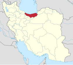 Location of Mazandaran Province in Iran | |
Coordinates: 36°30′N 52°35′E / 36.500°N 52.583°E / 36.500; 52.583Coordinates: 36°30′N 52°35′E / 36.500°N 52.583°E / 36.500; 52.583 | |
| Country | |
| Province | Mazandaran |
| Capital | Babol |
| Districts | Central District, Bandpey-ye Gharbi District, Bandpey-ye Sharqi District, Lalehabad District, Gatab District, Babol Kenar District, AmirKola District |
| Government | |
| • Governor | Rajab Molaie Raesi |
| Area[1] | |
| • Total | 1,578.10 km2 (609.31 sq mi) |
| Population (2012) | |
| • Total | 495,472 |
| • Density | 310/km2 (810/sq mi) |
| Time zone | UTC+3:30 (IRST) |
| • Summer (DST) | UTC+4:30 (IRDT) |
Babol County can be found at GEOnet Names Server, at this link, by opening the Advanced Search box, entering "-3193722" in the "Unique Feature Id" form, and clicking on "Search Database". | |
Babol County (Persian: شهرستان بابل) is a county in Mazandaran Province in Iran. The capital of the county is Babol. At the 2012 census, the county's population was 495,472, in 149,363 families.[2] The county is subdivided into Seven districts: the Central District, Bandpey-ye Gharbi District, Bandpey-ye Sharqi District, Lalehabad District, Gatab District, Babol Kenar District and Amirkola District. The county has seven cities: Babol, Amirkola, Galugah, Gatab, Khush Rudpey, Marzikola and Zargarmahalleh.
The most famous of Babol's historical buildings are Imamzadeh Ghasem (a holy shrine built at 15 AD), Ganjineh-ye-Babol, Mohammad Hassan Khan bridge, tower of the Royal Palace and the Jameh Mosque.[3]
Some notable families originating from Mazandaran, specifically Babol County are :
- Pahlavi Dynasty
- House of Karen
House of Moradi (branch of the House of Suren)- House of Sheren
- House of Batoul
The largest tribe from the Mazandaran region and Babol are the Balf.
References
^ Management and Planning Organization of Mazandaran, 2006
^ http://www.amar.org.ir/Portals/2/pdf/jamiat_shahrestan_keshvar.pdf%7C Iran Census2012
^ This Data comes from the "Book of Babol" noting the notable land owners, and aristocrats of the area.
- اطلس گیتاشناسی استانهای ایران [Atlas Gitashenasi Ostanhai Iran] (Gitashenasi Province Atlas of Iran)
- Babol.tk [Babol.tk] ([1])
| Capital |
| ||||||||||||||||||||||||||||||||||||||||
|---|---|---|---|---|---|---|---|---|---|---|---|---|---|---|---|---|---|---|---|---|---|---|---|---|---|---|---|---|---|---|---|---|---|---|---|---|---|---|---|---|---|
Counties and cities |
| ||||||||||||||||||||||||||||||||||||||||
| Sights | 
| ||||||||||||||||||||||||||||||||||||||||
| populated places | |||||||||||||||||||||||||||||||||||||||||
| Capital |
| ||||||||||||||||||||||||||||||||||||||||||||||||||||||||||||||
|---|---|---|---|---|---|---|---|---|---|---|---|---|---|---|---|---|---|---|---|---|---|---|---|---|---|---|---|---|---|---|---|---|---|---|---|---|---|---|---|---|---|---|---|---|---|---|---|---|---|---|---|---|---|---|---|---|---|---|---|---|---|---|---|
| Districts |
| ||||||||||||||||||||||||||||||||||||||||||||||||||||||||||||||
This Babol County location article is a stub. You can help Wikipedia by expanding it. |


