Bloléquin Department
Bloléquin Department Département de Bloléquin | |
|---|---|
Department | |
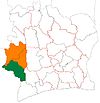
 Location in Ivory Coast. Bloléquin Department has retained the same boundaries since its creation in 2005. | |
| Country | |
| District | Montagnes |
| Region | Cavally |
| 2005 | Established as a second-level subdivision via a division of Guiglo Dept |
| 2011 | Converted to a third-level subdivision |
| Departmental seat | Bloléquin |
| Government [1] | |
| • Prefect | Yao Dinard Kouakou |
| Area [2] | |
| • Total | 2,962 km2 (1,144 sq mi) |
| Population (2014)[3] | |
| • Total | 123,336 |
| • Density | 42/km2 (110/sq mi) |
| Time zone | UTC+0 (GMT) |
Bloléquin Department is a department of Cavally Region in Montagnes District, Ivory Coast. In 2014, its population was 123,336 and its seat is the settlement of Bloléquin. The sub-prefectures of the department are Bloléquin, Diboké, Doké, Tinhou, and Zéaglo.
History
Bloléquin Department was created in 2005 as a second-level subdivision via a split-off from Guiglo Department.[4] At its creation, it was part of Moyen-Cavally Region.
In 2011, districts were introduced as new first-level subdivisions of Ivory Coast. At the same time, regions were reorganised and became second-level subdivisions and all departments were converted into third-level subdivisions. At this time, Bloléquin Department became part of Cavally Region in Montagnes District.
Notes
^ "Préfets de Région et de Préfets de Département (Conseil des ministres du mercredi 26 septembre 2012)", abidjan.net, 2 October 2012.
^ "Présentation de la Région du Cavally", cavally.org, accessed 23 February 2016.
^ "Côte d'Ivoire". geohive.com. Retrieved 5 December 2015..mw-parser-output cite.citation{font-style:inherit}.mw-parser-output .citation q{quotes:"""""""'""'"}.mw-parser-output .citation .cs1-lock-free a{background:url("//upload.wikimedia.org/wikipedia/commons/thumb/6/65/Lock-green.svg/9px-Lock-green.svg.png")no-repeat;background-position:right .1em center}.mw-parser-output .citation .cs1-lock-limited a,.mw-parser-output .citation .cs1-lock-registration a{background:url("//upload.wikimedia.org/wikipedia/commons/thumb/d/d6/Lock-gray-alt-2.svg/9px-Lock-gray-alt-2.svg.png")no-repeat;background-position:right .1em center}.mw-parser-output .citation .cs1-lock-subscription a{background:url("//upload.wikimedia.org/wikipedia/commons/thumb/a/aa/Lock-red-alt-2.svg/9px-Lock-red-alt-2.svg.png")no-repeat;background-position:right .1em center}.mw-parser-output .cs1-subscription,.mw-parser-output .cs1-registration{color:#555}.mw-parser-output .cs1-subscription span,.mw-parser-output .cs1-registration span{border-bottom:1px dotted;cursor:help}.mw-parser-output .cs1-ws-icon a{background:url("//upload.wikimedia.org/wikipedia/commons/thumb/4/4c/Wikisource-logo.svg/12px-Wikisource-logo.svg.png")no-repeat;background-position:right .1em center}.mw-parser-output code.cs1-code{color:inherit;background:inherit;border:inherit;padding:inherit}.mw-parser-output .cs1-hidden-error{display:none;font-size:100%}.mw-parser-output .cs1-visible-error{font-size:100%}.mw-parser-output .cs1-maint{display:none;color:#33aa33;margin-left:0.3em}.mw-parser-output .cs1-subscription,.mw-parser-output .cs1-registration,.mw-parser-output .cs1-format{font-size:95%}.mw-parser-output .cs1-kern-left,.mw-parser-output .cs1-kern-wl-left{padding-left:0.2em}.mw-parser-output .cs1-kern-right,.mw-parser-output .cs1-kern-wl-right{padding-right:0.2em}
^ "Regions of Côte d'Ivoire (Ivory Coast)", statoids.com, accessed 16 February 2016.
References
"Monographie : Bloléquin, un département d’énormes potentialités à valoriser", abidjan.net, 19 November 2014
Coordinates: 6°34′N 8°0′W / 6.567°N 8.000°W / 6.567; -8.000
This Montagnes District location article is a stub. You can help Wikipedia by expanding it. |

